MyTopo
New Point Indiana US Topo Map
Couldn't load pickup availability
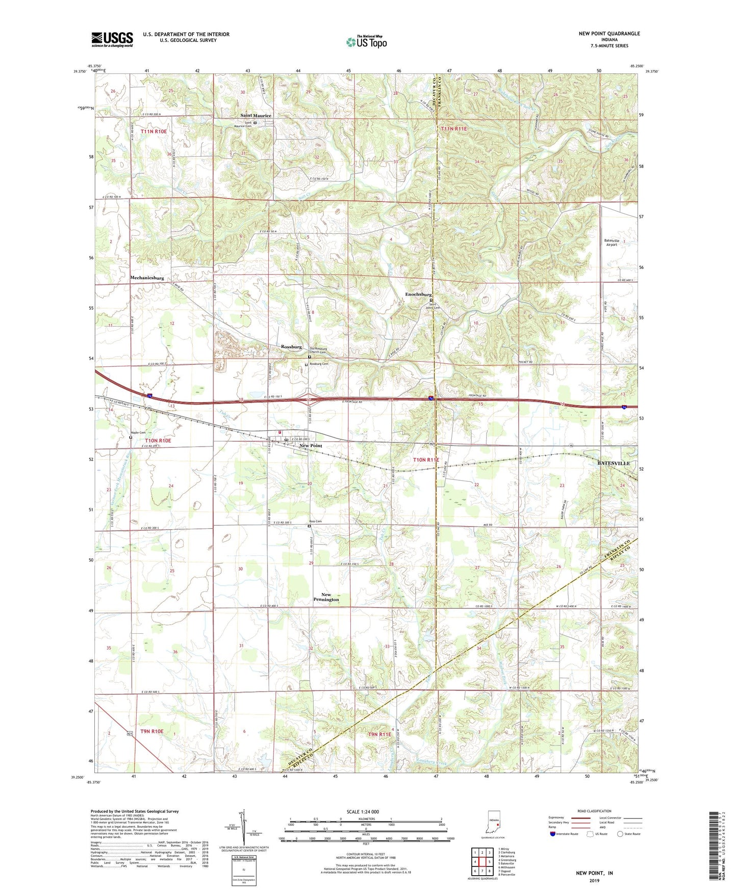
2022 topographic map quadrangle New Point in the state of Indiana. Scale: 1:24000. Based on the newly updated USGS 7.5' US Topo map series, this map is in the following counties: Decatur, Franklin, Ripley. The map contains contour data, water features, and other items you are used to seeing on USGS maps, but also has updated roads and other features. This is the next generation of topographic maps. Printed on high-quality waterproof paper with UV fade-resistant inks.
Quads adjacent to this one:
West: Greensburg
Northwest: Milroy
North: Clarksburg
Northeast: Metamora
East: Batesville
Southeast: Pierceville
South: Osgood
Southwest: Millhousen
This map covers the same area as the classic USGS quad with code o39085c3.
Contains the following named places: Batesville Airport, Enochsburg, Maple Cemetery, Mechanicsburg, New Pennington, New Point, New Point Marshals Department, New Point Post Office, New Point Quarry, New Point Volunteer Fire Department, Old Rossburg Church Cemetery, Puttmann Field, Righthand Fork Salt Creek, Rocket School, Ross Cemetery, Rossburg, Rossburg Cemetery, Saint Johns Cemetery, Saint Maurice, Saint Maurice Cemetery, Smiths Crossing, Town of New Point, Township of Laughery, Township of Saltcreek, Tub Creek, Walnut Fork, Wenning Jersey Farm, Zion Church, ZIP Code: 47263