MyTopo
Mount Ayr Indiana US Topo Map
Couldn't load pickup availability
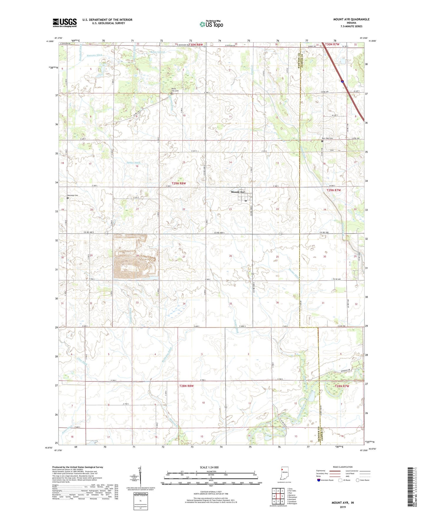
2022 topographic map quadrangle Mount Ayr in the state of Indiana. Scale: 1:24000. Based on the newly updated USGS 7.5' US Topo map series, this map is in the following counties: Newton, Jasper. The map contains contour data, water features, and other items you are used to seeing on USGS maps, but also has updated roads and other features. This is the next generation of topographic maps. Printed on high-quality waterproof paper with UV fade-resistant inks.
Quads adjacent to this one:
West: Morocco
Northwest: Enos
North: Fair Oaks
Northeast: Parr
East: Rensselaer
Southeast: Remington
South: Goodland
Southwest: Kentland
This map covers the same area as the classic USGS quad with code o40087h3.
Contains the following named places: Battleday Ditch, Beasy Lateral, Burr Oak Cemetery, Burr Oak Church, Camblin Ditch, Cline Ditch, Haines Ditch, Kennedy Cemetery, Mount Ayr, Mount Ayr Junior High School, Mount Ayr Post Office, North Star Cemetery, Spitler Ditch, Town of Mount Ayr, Township of Jackson, Turner Ditch, ZIP Codes: 47922, 47964