MyTopo
Remington Indiana US Topo Map
Couldn't load pickup availability
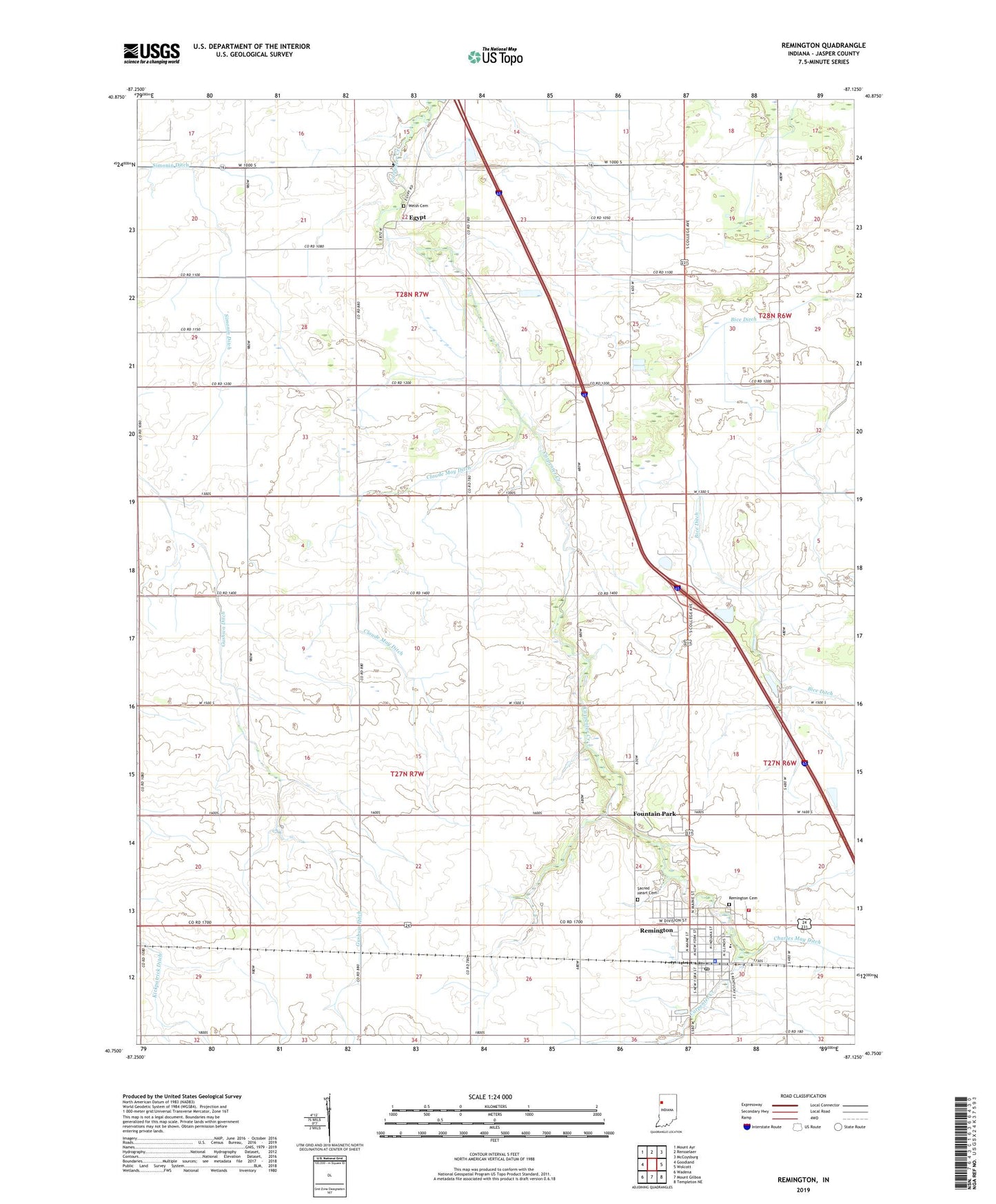
2022 topographic map quadrangle Remington in the state of Indiana. Scale: 1:24000. Based on the newly updated USGS 7.5' US Topo map series, this map is in the following counties: Jasper. The map contains contour data, water features, and other items you are used to seeing on USGS maps, but also has updated roads and other features. This is the next generation of topographic maps. Printed on high-quality waterproof paper with UV fade-resistant inks.
Quads adjacent to this one:
West: Goodland
Northwest: Mount Ayr
North: Rensselaer
Northeast: McCoysburg
East: Wolcott
Southeast: Templeton NE
South: Mount Gilboa
Southwest: Wadena
This map covers the same area as the classic USGS quad with code o40087g2.
Contains the following named places: Bice Ditch, Charles May Ditch, Claude May Ditch, Egypt, Fountain Park, Foxhill Hog Farm, Gushwa Ditch, Jordan School, Kirkpatrick Ditch, Remington, Remington Cemetery, Remington City Fire Department, Remington Police Department, Remington Post Office, Sacred Heart Cemetery, Simonin Ditch, Southern Jasper County Ambulance Service, Town of Remington, Township of Carpenter, Township of Jordan, Tri-County West Elementary School, Welsh Cemetery, ZIP Code: 47977