MyTopo
Mount Gilboa Indiana US Topo Map
Couldn't load pickup availability
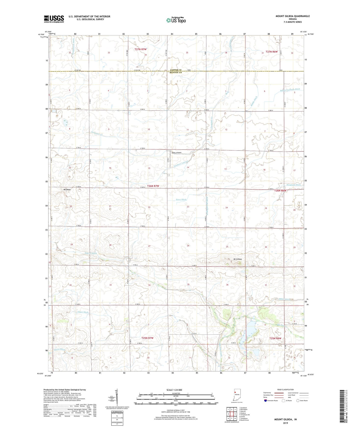
2022 topographic map quadrangle Mount Gilboa in the state of Indiana. Scale: 1:24000. Based on the newly updated USGS 7.5' US Topo map series, this map is in the following counties: Benton, Jasper. The map contains contour data, water features, and other items you are used to seeing on USGS maps, but also has updated roads and other features. This is the next generation of topographic maps. Printed on high-quality waterproof paper with UV fade-resistant inks.
Quads adjacent to this one:
West: Wadena
Northwest: Goodland
North: Remington
Northeast: Wolcott
East: Templeton NE
Southeast: Round Grove
South: Templeton
Southwest: Fowler
This map covers the same area as the classic USGS quad with code o40087f2.
Contains the following named places: Ashby Airport, Bethany Chapel, Biddle Ditch, Ferry Ditch, Lague Ditch, Lambert Lateral, Mount Gilboa, Mount Nebo, Owens Ditch, Pine Creek Ditch, Township of Gilboa, Wealing Airport