MyTopo
Wolcott Indiana US Topo Map
Couldn't load pickup availability
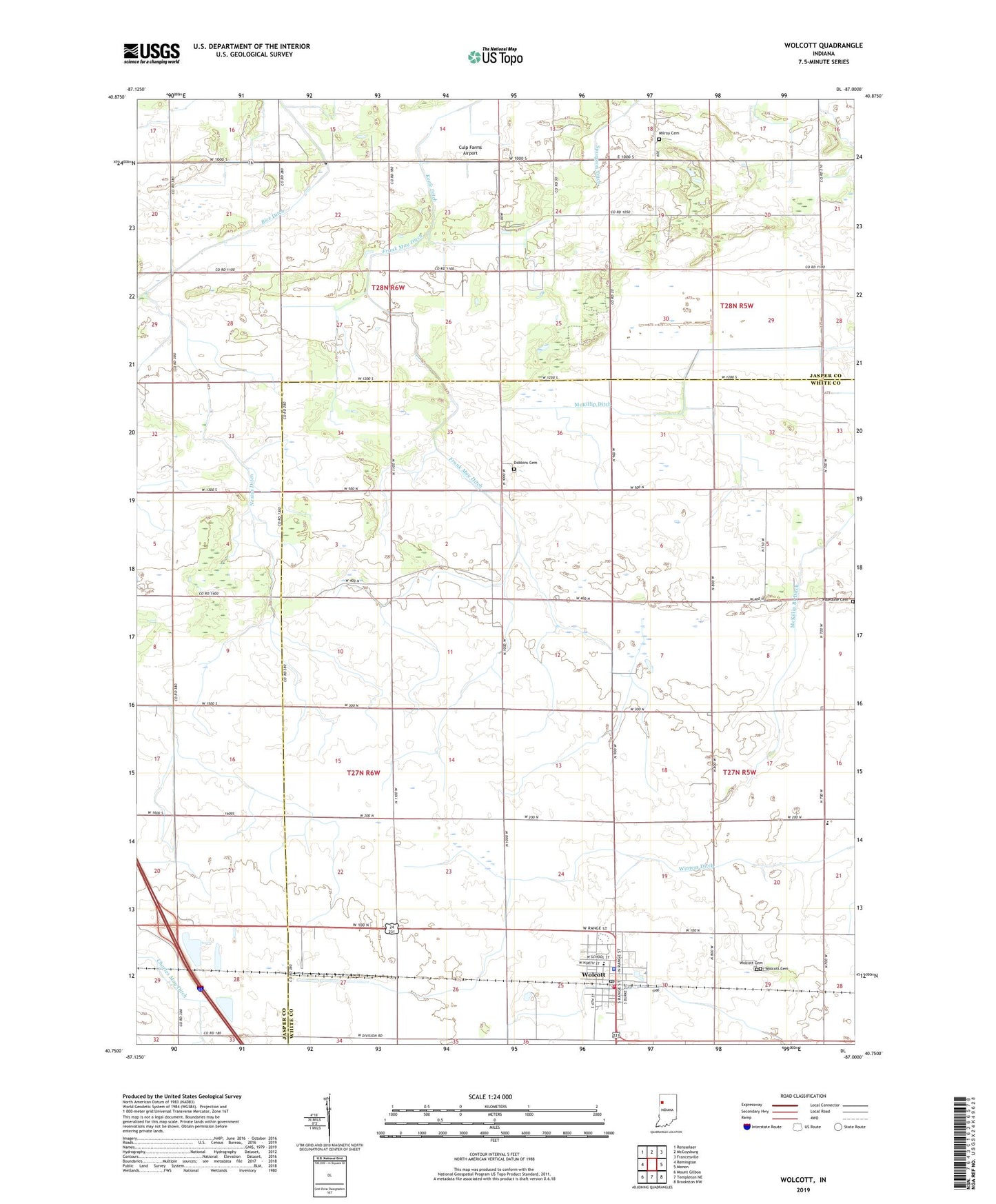
2022 topographic map quadrangle Wolcott in the state of Indiana. Scale: 1:24000. Based on the newly updated USGS 7.5' US Topo map series, this map is in the following counties: White, Jasper. The map contains contour data, water features, and other items you are used to seeing on USGS maps, but also has updated roads and other features. This is the next generation of topographic maps. Printed on high-quality waterproof paper with UV fade-resistant inks.
Quads adjacent to this one:
West: Remington
Northwest: Rensselaer
North: McCoysburg
Northeast: Francesville
East: Monon
Southeast: Brookston NW
South: Templeton NE
Southwest: Mount Gilboa
This map covers the same area as the classic USGS quad with code o40087g1.
Contains the following named places: Culp Farms Airport, Dobbins Cemetery, Frank May Ditch, James Airport, Keefe Ditch, McKillip Branch Ditch, Milroy Cemetery, Mount Zion Church, Nesius Ditch, Palestine Cemetery, Palestine Church, Town of Wolcott, Township of Milroy, Township of Princeton, Wolcott, Wolcott Cemetery, Wolcott Community Airport, Wolcott Police Department, Wolcott Post Office, Wolcott Volunteer Ambulance Service, Wolcott Volunteer Fire Department, ZIP Code: 47995