MyTopo
New Amsterdam Indiana US Topo Map
Couldn't load pickup availability
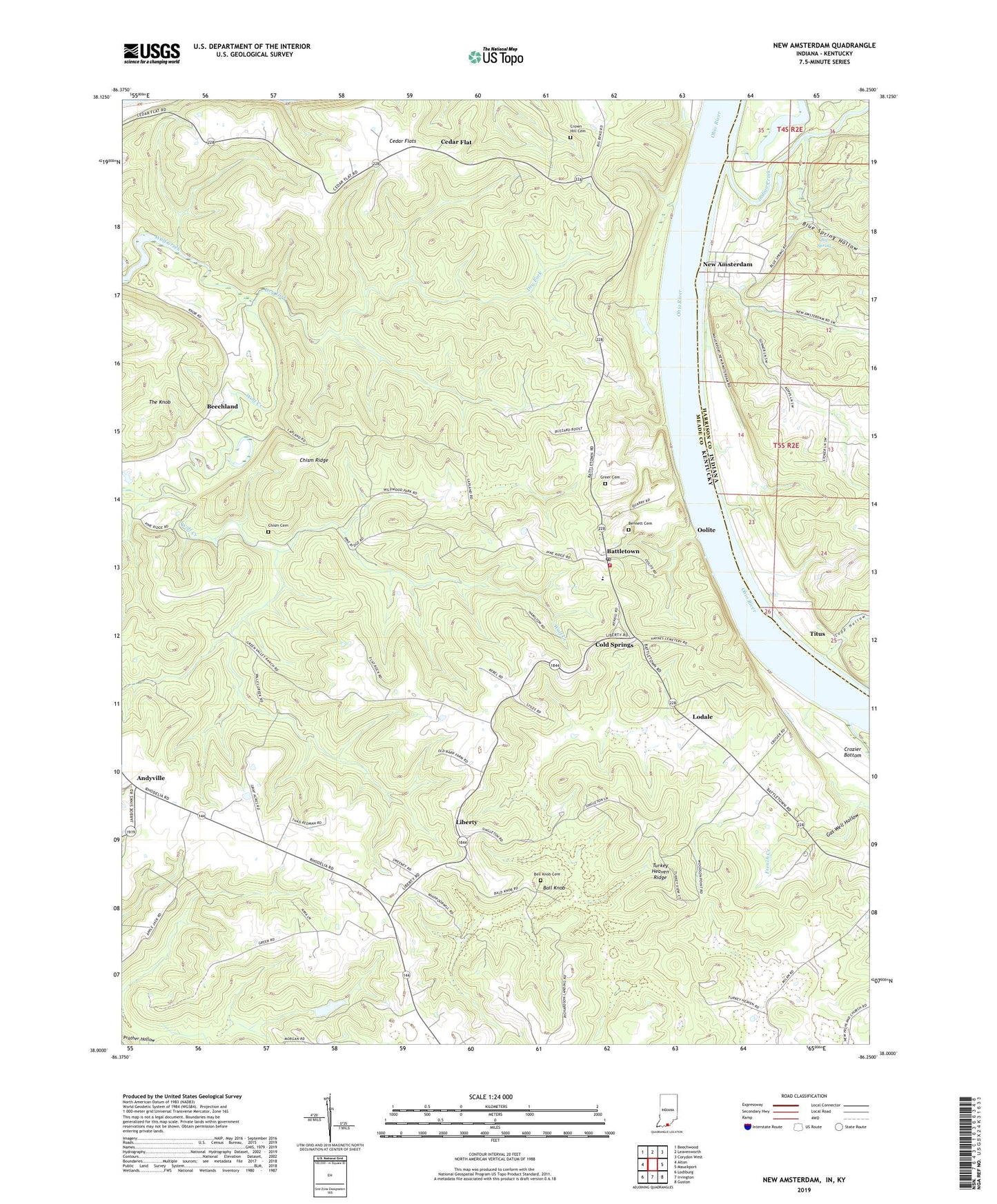
2022 topographic map quadrangle New Amsterdam in the states of Kentucky, Indiana. Scale: 1:24000. Based on the newly updated USGS 7.5' US Topo map series, this map is in the following counties: Harrison, Meade. The map contains contour data, water features, and other items you are used to seeing on USGS maps, but also has updated roads and other features. This is the next generation of topographic maps. Printed on high-quality waterproof paper with UV fade-resistant inks.
Quads adjacent to this one:
West: Alton
Northwest: Beechwood
North: Leavenworth
Northeast: Corydon West
East: Mauckport
Southeast: Guston
South: Irvington
Southwest: Lodiburg
Contains the following named places: Andyville, Ball Knob, Ball Knob Cemetery, Battletown, Battletown Fire Department, Battletown Post Office, Battletown-Payneville Division, Beechland, Big Spring, Blue Spring Hollow, Bogard - Greer Cemetery, Brock Creek, Cedar Flat, Cedar Flats, Chism Cemetery, Chism Ridge, Cold Springs, Crown Hill Cemetery, Crozier Bottom, Dry Fork, French Creek, Gas Well Hollow, Indian Creek, Lapland, Lawson Park, Liberty, Lodale, Lopp Hollow, Lopps Landing, Marve Bennett Cemetery, Mint Springs, New Amsterdam, Oolite, Overflow Pond, Prather Hollow, The Knob, Titus, Town of New Amsterdam, Turkey Heaven Ridge, ZIP Code: 40104