MyTopo
Alton Indiana US Topo Map
Couldn't load pickup availability
Also explore the Alton Forest Service Topo of this same quad for updated USFS data
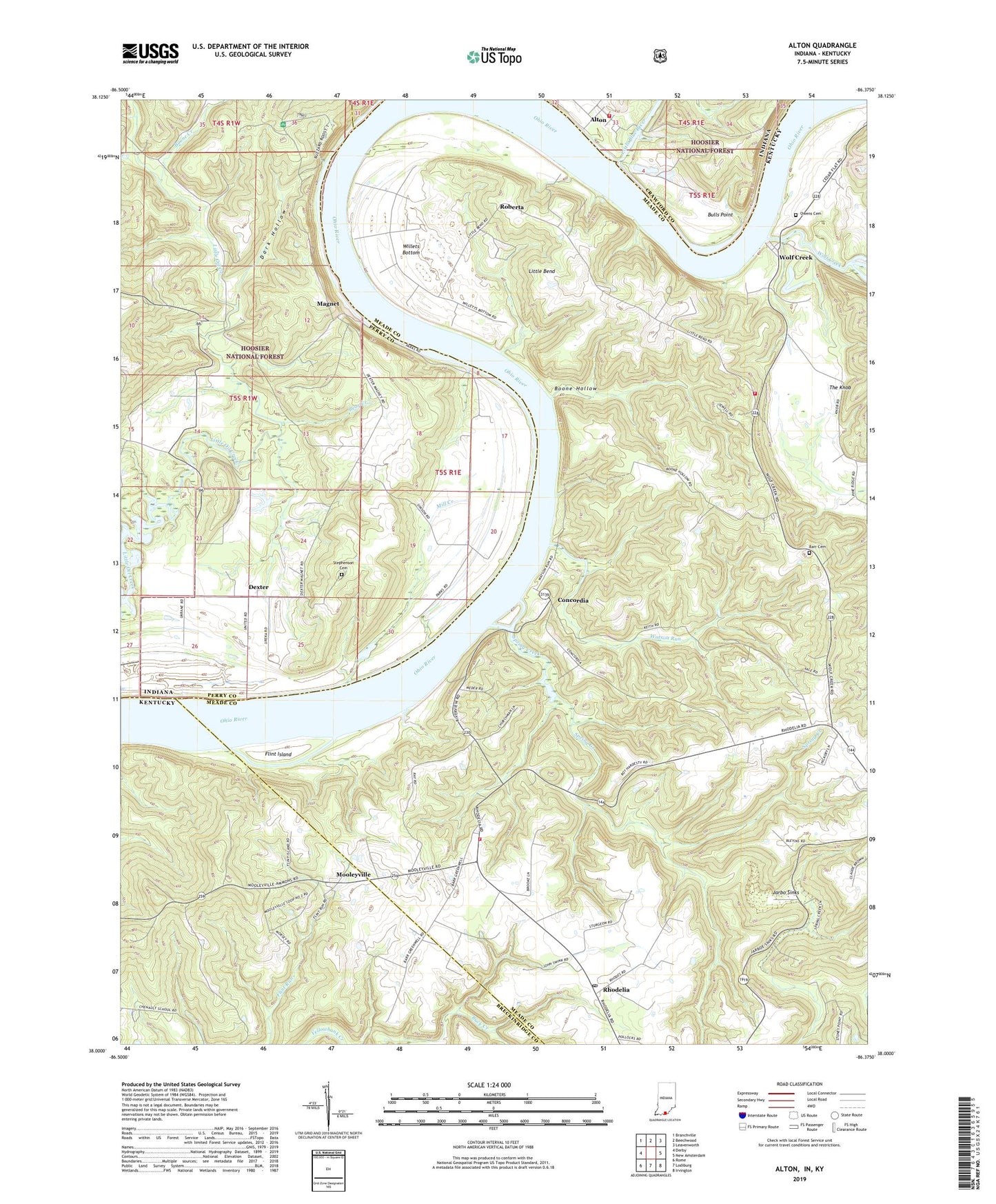
2022 topographic map quadrangle Alton in the states of Kentucky, Indiana. Scale: 1:24000. Based on the newly updated USGS 7.5' US Topo map series, this map is in the following counties: Perry, Meade, Breckinridge, Crawford. The map contains contour data, water features, and other items you are used to seeing on USGS maps, but also has updated roads and other features. This is the next generation of topographic maps. Printed on high-quality waterproof paper with UV fade-resistant inks.
Quads adjacent to this one:
West: Derby
Northwest: Branchville
North: Beechwood
Northeast: Leavenworth
East: New Amsterdam
Southeast: Irvington
South: Lodiburg
Southwest: Rome
Contains the following named places: Alton, Bear Creek, Boone Creek, Boone Hollow, Bulls Point, Buzzard Roost Overlook, Concordia, Cross Roads Church, Dark Hollow, Dexter, Eagle's Nest Airport, Flint Island, Jarbo Sinks, Leavenworth Volunteer Fire Department, Little Bend, Little Blue River, Magnet, Mill Creek, Mooleyville, Owings Cemetery, Parr - Frans Cemetery, Peters Landing, Rhodelia, Rhodelia Fire Department, Rhodelia Post Office, Roberta, Sacred Heart Church, Saint Theresa Academy, Spring Creek, Stephenson Cemetery, Stony Point, Town of Alton, Watson Run, Willets Bottom, Wolf Creek, Wolf Creek Fire Department, ZIP Codes: 40157, 40161