MyTopo
Newport Indiana US Topo Map
Couldn't load pickup availability
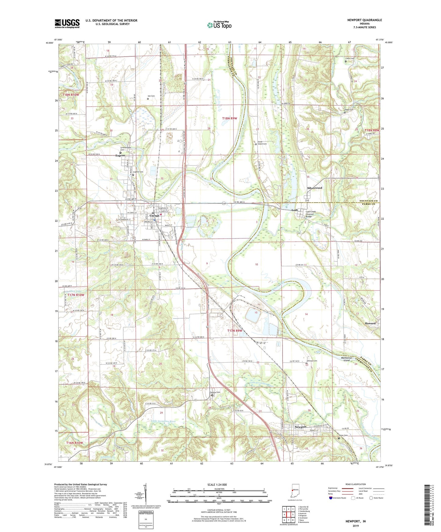
2022 topographic map quadrangle Newport in the state of Indiana. Scale: 1:24000. Based on the newly updated USGS 7.5' US Topo map series, this map is in the following counties: Vermillion, Fountain, Parke. The map contains contour data, water features, and other items you are used to seeing on USGS maps, but also has updated roads and other features. This is the next generation of topographic maps. Printed on high-quality waterproof paper with UV fade-resistant inks.
Quads adjacent to this one:
West: Humrick
Northwest: Danville SE
North: Perrysville
Northeast: Veedersburg
East: Kingman
Southeast: Montezuma
South: Dana
Southwest: Scottland
This map covers the same area as the classic USGS quad with code o39087h4.
Contains the following named places: Cates Cemetery, Cayuga, Cayuga Elementary School, Cayuga Police Department, Cayuga Post Office, Cayuga Shale Pit, Cayuga Volunteer Fire and Rescue, Chew Lake, Chew Lake Dam, Coal Creek, Coal Creek Covered Bridge, Collett Orphanage, Dry Branch, Eugene, Eugene Cemetery, Groenendyke Cemetery, Hibbs Cemetery, Howard, Isle Cemetery, Johnson Cemetery, Jonathan Creek, Lindsey Chapel, Little Vermilion River, Lodi, Manhattan Island, Mill Creek, Newport, Newport Elementary School, North Vermillion High School, Silver Island Cemetery, Silverwood, Thomas Cemetery, Town of Cayuga, Town of Newport, Township of Eugene, Township of Fulton, Vermilion River, Vermillion County Emergency Medical Services Station 1, Waterman Church, Zener Cemetery, ZIP Codes: 47928, 47966