MyTopo
Dana Indiana US Topo Map
Couldn't load pickup availability
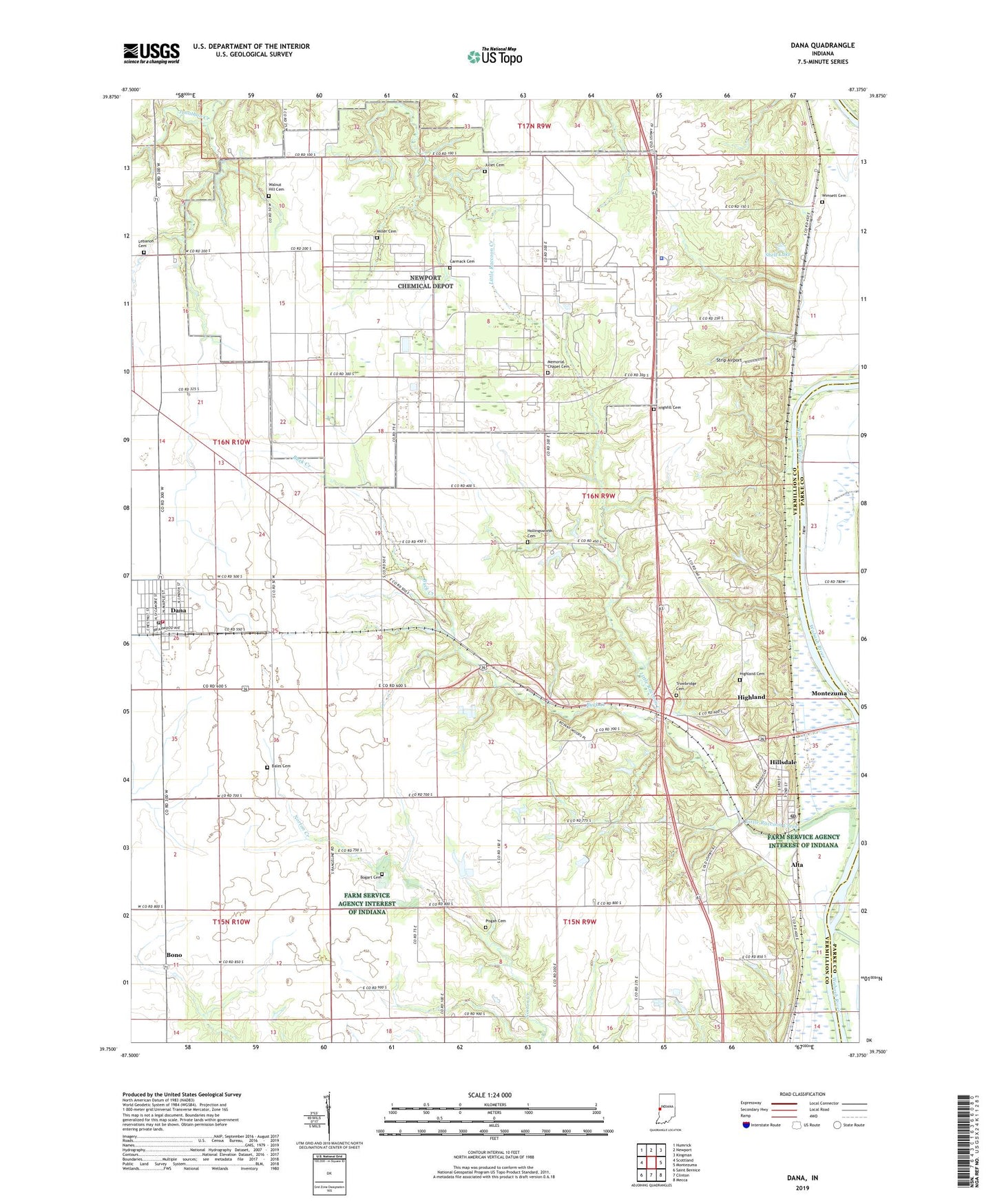
2022 topographic map quadrangle Dana in the state of Indiana. Scale: 1:24000. Based on the newly updated USGS 7.5' US Topo map series, this map is in the following counties: Vermillion, Parke. The map contains contour data, water features, and other items you are used to seeing on USGS maps, but also has updated roads and other features. This is the next generation of topographic maps. Printed on high-quality waterproof paper with UV fade-resistant inks.
Quads adjacent to this one:
West: Scottland
Northwest: Humrick
North: Newport
Northeast: Kingman
East: Montezuma
Southeast: Mecca
South: Clinton
Southwest: Saint Bernice
This map covers the same area as the classic USGS quad with code o39087g4.
Contains the following named places: Alta, Bales Cemetery, Big Raccoon Creek, Bogart Cemetery, Bono, Buck Creek, Carmack Cemetery, Dana, Dana Community Volunteer Fire Department, Dana Post Office, Dana Town Marshal, Early Station, Ernie Pyle Rest Park, Highfill Cemetery, Highland, Highland Cemetery, Hillsdale, Hillsdale Junction, Hillsdale Post Office, Hollingsworth Cemetery, Juliet Cemetery, Lebanon Cemetery, Little Raccoon Creek, Memorial Chapel Cemetery, Miller Cemetery, Montezuma Station, Newport Chemical Depot, Pisgah Cemetery, Shell Lake, Shell Lake Dam, Strip Airport, Tennessee Valley Church, Toronto, Town of Dana, Township of Helt, Township of Vermillion, Trowbridge Cemetery, Vermillion County, Vermillion County Sheriff's Office, Walnut Hill Cemetery, Wimsett Cemetery, ZIP Codes: 47847, 47854