MyTopo
Kingman Indiana US Topo Map
Couldn't load pickup availability
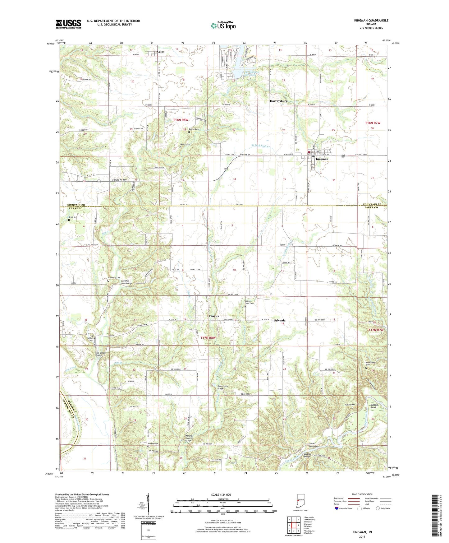
2022 topographic map quadrangle Kingman in the state of Indiana. Scale: 1:24000. Based on the newly updated USGS 7.5' US Topo map series, this map is in the following counties: Parke, Fountain, Vermillion. The map contains contour data, water features, and other items you are used to seeing on USGS maps, but also has updated roads and other features. This is the next generation of topographic maps. Printed on high-quality waterproof paper with UV fade-resistant inks.
Quads adjacent to this one:
West: Newport
Northwest: Perrysville
North: Veedersburg
Northeast: Hillsboro
East: Wallace
Southeast: Rockville
South: Montezuma
Southwest: Dana
This map covers the same area as the classic USGS quad with code o39087h3.
Contains the following named places: Baker Cemetery, Bethel Cemetery, Bowsher Ford Bridge, Bristleridge Cemetery, Brockway Cemetery, Cates, Devils Den, East Fork Rush Creek, East Liberty Church, Ephlin Cemetery, Fairview Church, Harvey Cemetery, Harveysburg, Jackson Bridge, Jim Branch, Kingman, Kingman Post Office, Kingman Volunteer Fire Department, Lake Holiday Hide-away, Lake Holiday Hide-Away Dam, Marshall Covered Bridge, Mill Creek Bridge, Mount Hermon Church, Norton Cemetery, Pot Rock Hollow, Roaring Creek, Rockport, Rush Creek Bridge, Rush Creek Cemetery, Rush Creek Church, Russell Bend, Russell Cemetery, Shirk Cemetery, Sylvania, Tangier, Town of Kingman, Township of Liberty, West Fork Rush Creek, ZIP Codes: 47832, 47952