MyTopo
Wolcottville Indiana US Topo Map
Couldn't load pickup availability
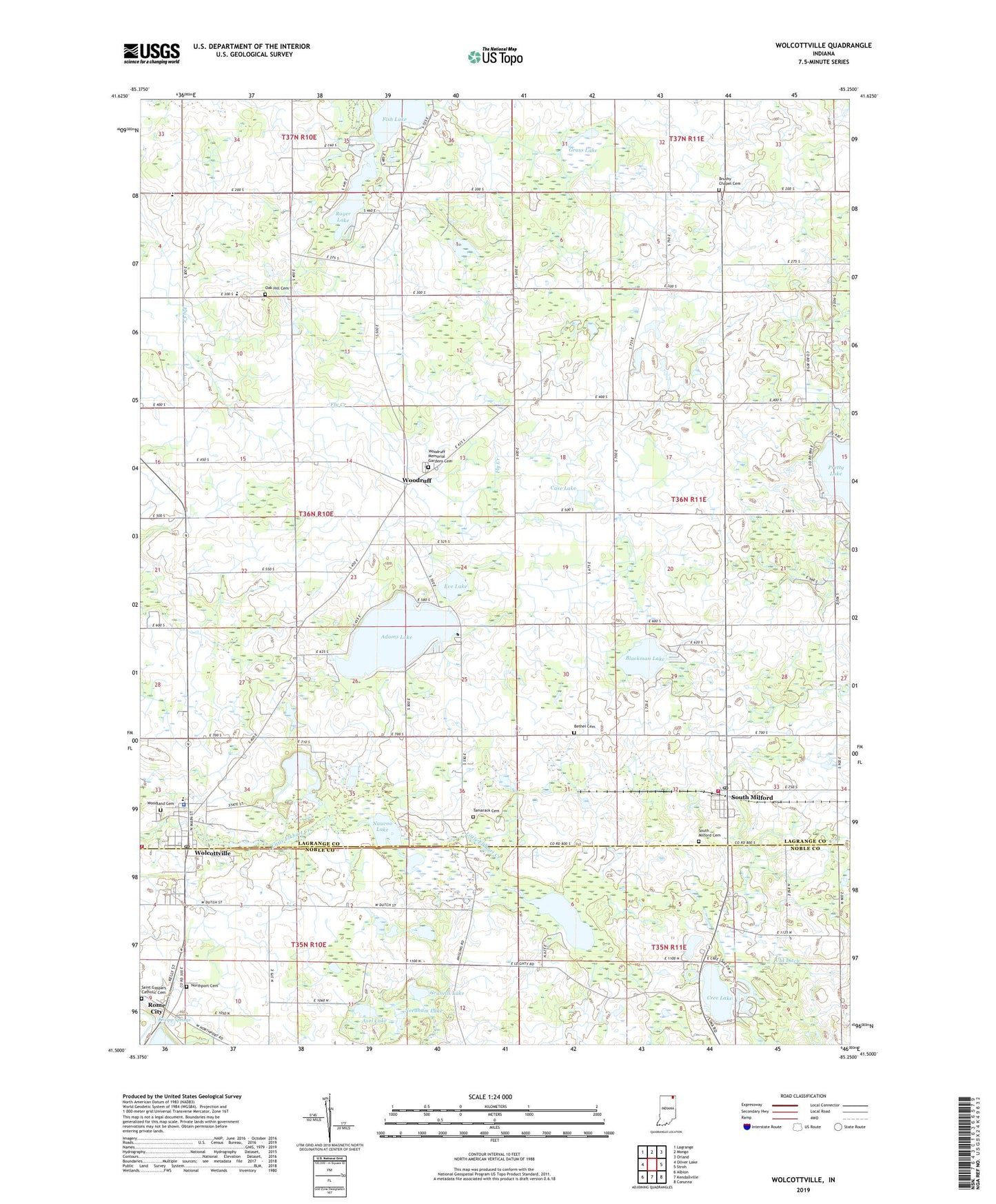
2022 topographic map quadrangle Wolcottville in the state of Indiana. Scale: 1:24000. Based on the newly updated USGS 7.5' US Topo map series, this map is in the following counties: LaGrange, Noble. The map contains contour data, water features, and other items you are used to seeing on USGS maps, but also has updated roads and other features. This is the next generation of topographic maps. Printed on high-quality waterproof paper with UV fade-resistant inks.
Quads adjacent to this one:
West: Oliver Lake
Northwest: Lagrange
North: Mongo
Northeast: Orland
East: Stroh
Southeast: Corunna
South: Kendallville
Southwest: Albion
This map covers the same area as the classic USGS quad with code o41085e3.
Contains the following named places: Adams Lake, Axel Lake, Bethel Cemetery, Blackman Lake, Brushy Chapel, Brushy Chapel Cemetery, Case Lake, Church of Christ, Church of God, Church of the True God, Community Baptist Church, Cree Lake, Eve Lake, First Methodist Church, Fish Lake, Five Corners Baptist Church, Fort Wayne YMCA-Camp Potawotami, Grannis Lake, Grass Lake, Henschen Pit, Johnson Township Fire Department, Kneipp Springs, Kneipp Springs Sanitarium, Messiah Lutheran Church, Mud Lake, Nauvoo Lake, Needham Lake, Newman Lake, Northport Cemetery, Oak Grove Church, Oak Hill Cemetery, Oak Hill School, Roger Lake, Royer Lake, Saint Gaspars Catholic Cemetery, Saint Gaspars Church, South Milford, South Milford Cemetery, South Milford Fire Department, South Milford Independent Baptist Church, South Milford Post Office, Tamarack Cemetery, Tamarack Lake, The Way College of Biblical Research, Town of Wolcottville, Township of Johnson, Township of Milford, Wolcott Mills Elementary School, Wolcottville, Wolcottville Methodist Church, Wolcottville Police Department, Wolcottville Post Office, Wolcottville Sand and Gravel Pit, Woodland Cemetery, Woodruff, Woodruff Grove United Methodist Church, Woodruff Memorial Gardens Cemetery, ZIP Codes: 46786, 46795


