MyTopo
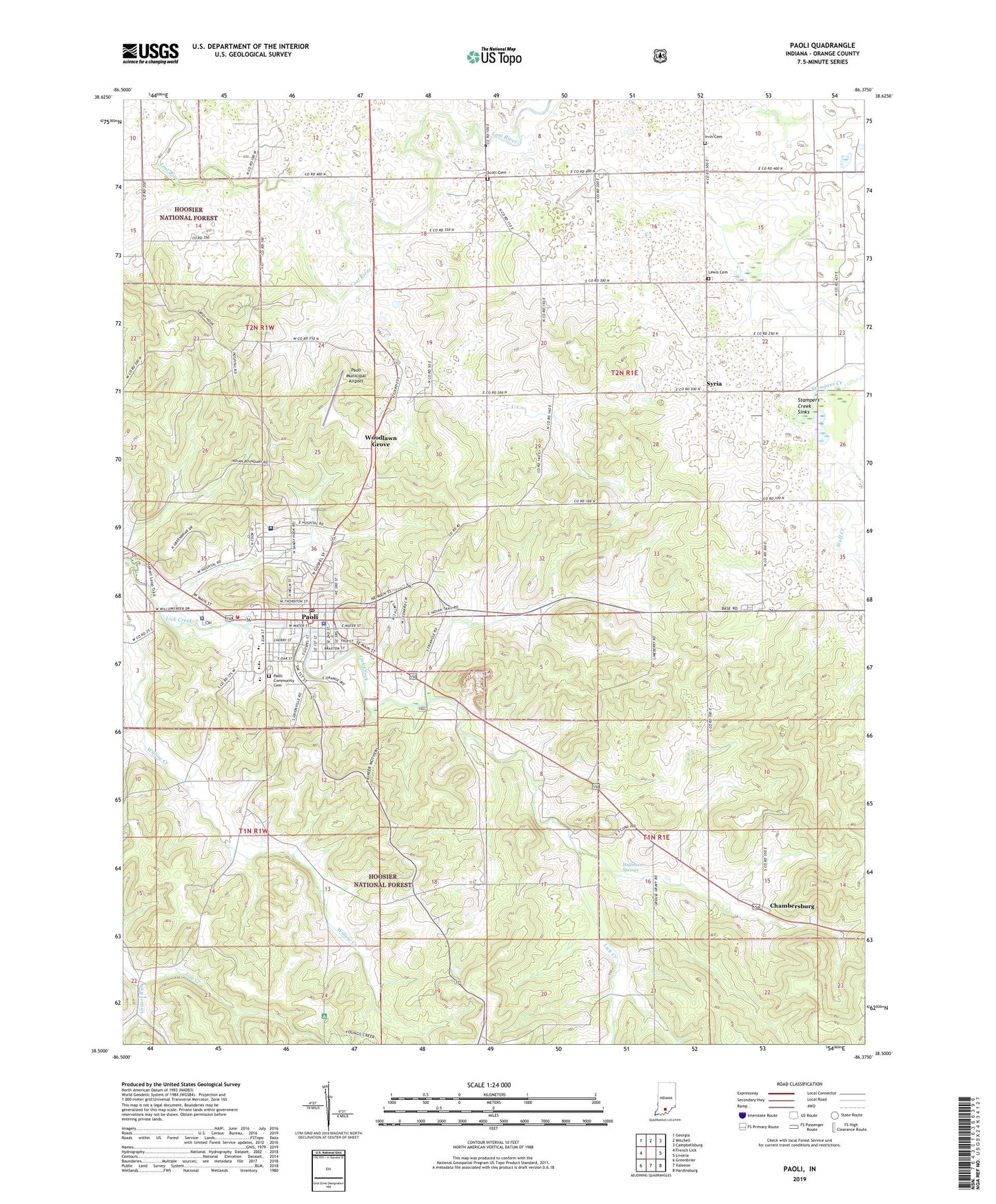
Paoli Indiana US Topo Map
Couldn't load pickup availability
Also explore the Paoli Forest Service Topo of this same quad for updated USFS data
2022 topographic map quadrangle Paoli in the state of Indiana. Scale: 1:24000. Based on the newly updated USGS 7.5' US Topo map series, this map is in the following counties: Orange. The map contains contour data, water features, and other items you are used to seeing on USGS maps, but also has updated roads and other features. This is the next generation of topographic maps. Printed on high-quality waterproof paper with UV fade-resistant inks.
Quads adjacent to this one:
West: French Lick
Northwest: Georgia
North: Mitchell
Northeast: Campbellsburg
East: Livonia
Southeast: Hardinsburg
South: Valeene
Southwest: Greenbrier
This map covers the same area as the classic USGS quad with code o38086e4.
Contains the following named places: Air Evacuation Lifeteam 17 Emergency Medical Services, Beech Grove Church, Braxtons Siding, Calcar Quarry, Chambersburg, Christ of King Church, Gravel Run, Halfmoon Springs, Irvin Cemetery, IU Health Paoli Hospital, Lewis Cemetery, Lick Creek Church, Lost River, Lost River Game Farm, Mount Gilead Church, Mount Pleasant Church, Newberry Church, Orange County, Orange County Courthouse, Orange County Sheriff's Office, Paoli, Paoli Community Cemetery, Paoli Fire Department, Paoli Junior and Senior High School, Paoli Municipal Airport, Paoli Police Department, Paoli Post Office, Pioneer Mothers Memorial Forest, Pioneer Mothers State Wayside, Scott Cemetery, Spring Mill, Stampers Creek, Stampers Creek Church, Stampers Creek Sinks, Stouts Chapel, Syria, Throop Elementary School Number 1, Town of Paoli, Township of Paoli, WKKX-AM (Paoli), Wolf Creek, Woodlawn Grove, WVAK, WVME-FM (Paoli), ZIP Code: 47454