MyTopo
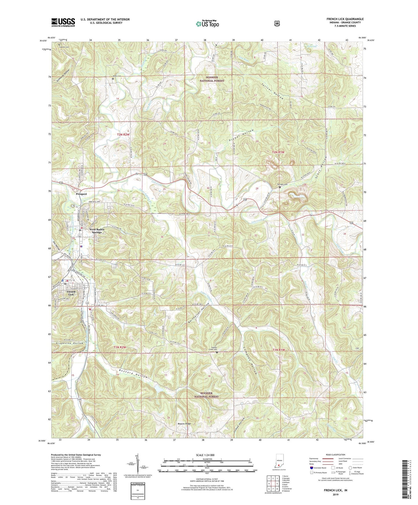
French Lick Indiana US Topo Map
Couldn't load pickup availability
Also explore the French Lick Forest Service Topo of this same quad for updated USFS data
2022 topographic map quadrangle French Lick in the state of Indiana. Scale: 1:24000. Based on the newly updated USGS 7.5' US Topo map series, this map is in the following counties: Orange. The map contains contour data, water features, and other items you are used to seeing on USGS maps, but also has updated roads and other features. This is the next generation of topographic maps. Printed on high-quality waterproof paper with UV fade-resistant inks.
Quads adjacent to this one:
West: Hillham
Northwest: Huron
North: Georgia
Northeast: Mitchell
East: Paoli
Southeast: Valeene
South: Greenbrier
Southwest: Cuzco
This map covers the same area as the classic USGS quad with code o38086e5.
Contains the following named places: Abydel, Ames Chapel, Barnheisel Hollow, Buzzard Hollow, Cave Quarries, Compton Hollow, Dry Hollow, Elrod Gulf, Faucett Cemetery, French Lick, French Lick Creek, French Lick Fire Department, French Lick Police Department, French Lick Post Office, Grapevine Hollow, Hoosier National Forest, Lick Creek, Log Creek, Miller Cemetery, Moores Ridge, Moores Ridge Church, Orange County Rural Fire Department 1, Paoli Experimental Forest, Pipher Hollow, Prospect, Sand Creek, Scott Hollow, Shirley Creek, Springer Cemetery, Springs Valley Community High School, Springs Valley Elementary School, Springs Valley Structure Number F-3 Dam, Sulphur Creek Cemetery, Toliver Hollow, Town of French Lick, Town of West Baden Springs, Township of French Lick, Turleys, Upper Sulphur Creek, West Baden Fire Department, West Baden Springs, West Baden Springs Police Department, West Baden Springs Post Office, West Baden Springs Volunteer Fire Department, WFLQ-FM (French Lick), Willow Creek