MyTopo
Petroleum Indiana US Topo Map
Couldn't load pickup availability
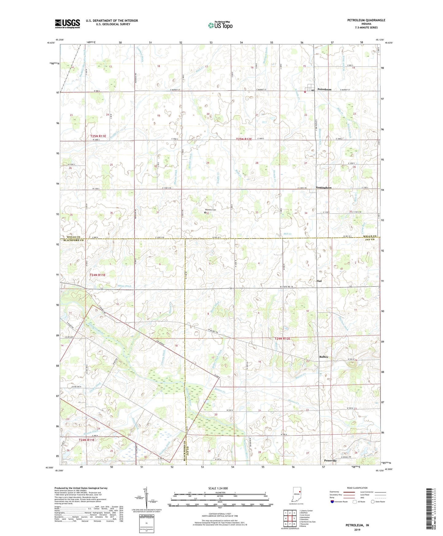
2022 topographic map quadrangle Petroleum in the state of Indiana. Scale: 1:24000. Based on the newly updated USGS 7.5' US Topo map series, this map is in the following counties: Jay, Wells, Blackford. The map contains contour data, water features, and other items you are used to seeing on USGS maps, but also has updated roads and other features. This is the next generation of topographic maps. Printed on high-quality waterproof paper with UV fade-resistant inks.
Quads adjacent to this one:
West: Montpelier
Northwest: Liberty Center
North: Bluffton
Northeast: Linn Grove
East: Domestic
Southeast: Blaine
South: Pennville
Southwest: Hartford City East
This map covers the same area as the classic USGS quad with code o40085e2.
Contains the following named places: Balbec, Beaver Creek, Beckler Ditch, Bills Creek, Bloxsom Cemetery, Bloxsom Ditch, Chaney Ditch, Fiat, Gieger Ditch, Gilead Church, Haines Creek, Hickman Ditch, McClain Ditch, Mill Creek, Miller Pugh Ditch, Mulligan Ditch, Nottingham, Nottingham Township Volunteer Fire Department, Oswalt Hog Farm, Petroleum, Petroleum Post Office, Petroleum School, Sharpe Ditch, Shinn Ditch, Shook Ditch, Slocum Ditch, Stoney Creek, Township of Nottingham, Township of Penn, Union Chapel, Warner Ditch, Wilson Ditch, ZIP Codes: 46759, 47369