MyTopo
Blaine Indiana US Topo Map
Couldn't load pickup availability
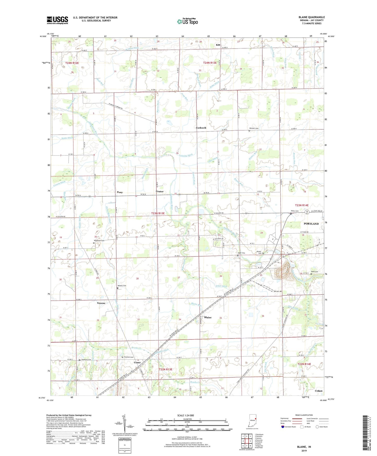
2022 topographic map quadrangle Blaine in the state of Indiana. Scale: 1:24000. Based on the newly updated USGS 7.5' US Topo map series, this map is in the following counties: Jay. The map contains contour data, water features, and other items you are used to seeing on USGS maps, but also has updated roads and other features. This is the next generation of topographic maps. Printed on high-quality waterproof paper with UV fade-resistant inks.
Quads adjacent to this one:
West: Pennville
Northwest: Petroleum
North: Domestic
Northeast: Geneva
East: Portland
Southeast: Deerfield
South: Ridgeville
Southwest: Redkey
This map covers the same area as the classic USGS quad with code o40085d1.
Contains the following named places: Bealton Ditch, Blaine, Blaine Run, Butternut Creek, Cartwright Ditch, Cassell Ditch, Center, Collett, Como, Como Run, Corkwell, Dority Ditch, Elm Brook, Elm Grove Church, Fence Run, Franks Ditch, Glenn Miller Ditch, Greene, Hahn Ditch, Hearn Cemetery, Hearne Run, Hopewell Church, Jay County, Kinsey Cemetery, Kinsey Run, Kitt, Lanning Ditch, Man Run, May Ditch, McKinley Ditch, Miller Ditch, Myran Ditch, New Mount Run, Pony, Pony Run, Portland Quarry, Priest Ditch, Reed Cemetery, Sager Cemetery, Sipe Ditch, Stephens Cemetery, Stephens Run, Stratton Cemetery, Stultz Ditch, Sugar Grove Church, Thomas Ditch, Township of Greene, Union Church, Wall Run, Walling Ditch, Walnut Corner Church, Whaley Cemetery, Whicker Cemetery, Whiteman Cemetery, Wicker Run, Wikel Ditch