MyTopo
Bluffton Indiana US Topo Map
Couldn't load pickup availability
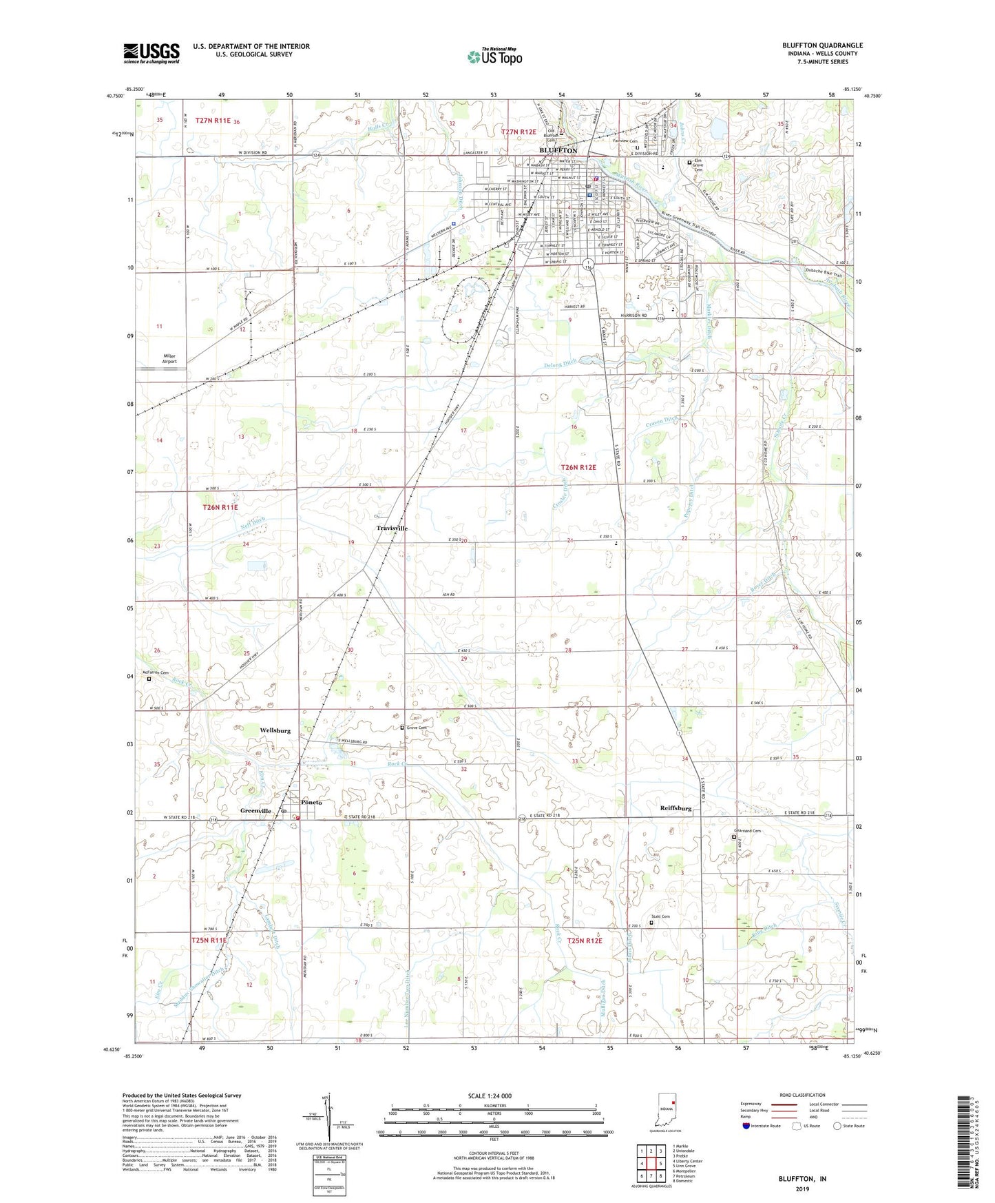
2022 topographic map quadrangle Bluffton in the state of Indiana. Scale: 1:24000. Based on the newly updated USGS 7.5' US Topo map series, this map is in the following counties: Wells. The map contains contour data, water features, and other items you are used to seeing on USGS maps, but also has updated roads and other features. This is the next generation of topographic maps. Printed on high-quality waterproof paper with UV fade-resistant inks.
Quads adjacent to this one:
West: Liberty Center
Northwest: Markle
North: Uniondale
Northeast: Preble
East: Linn Grove
Southeast: Domestic
South: Petroleum
Southwest: Montpelier
This map covers the same area as the classic USGS quad with code o40085f2.
Contains the following named places: 4-H Park, Allen School, Bethel Church, Bluffton, Bluffton Fire Department, Bluffton Police Department, Bluffton Post Office, Bluffton Regional Medical Center, Boyer Ditch, Brinnemans Headacres Airport, Central School, City of Bluffton, Columbian Elementary School, Craven Ditch, Crosbie Ditch, Delong Ditch, East Side Elementary School, Elm Creek, Elm Grove Cemetery, Fairview Cemetery, Gearnand Cemetery, Greenville, Grove Cemetery, Irvin Ditch, Jefferson Park, Johns Creek, Johns Ditch, Johnson Ditch, King Ditch, Lambert Ditch, Lee Number Two Ditch, Maddux-Showalter Ditch, Markley Ditch, McFarren Cemetery, Miller Airport, Old Bluffton Cemetery, Old Columbian School, Park School, Poneto, Poneto Post Office, Poneto Volunteer Fire Department, Popejoy Ditch, Popular Grove School, Prairie Church, Reiffsburg, Sixmile Church, Sixmile Creek, Stahl Cemetery, Town of Poneto, Township of Harrison, Travisville, Washington Park, WCRD-FM (Bluffton), Wells County, Wells County Emergency Medical Services - Bluffton Station, Wells County Sheriff's Office, Wellsburg, ZIP Code: 46714