MyTopo
Linn Grove Indiana US Topo Map
Couldn't load pickup availability
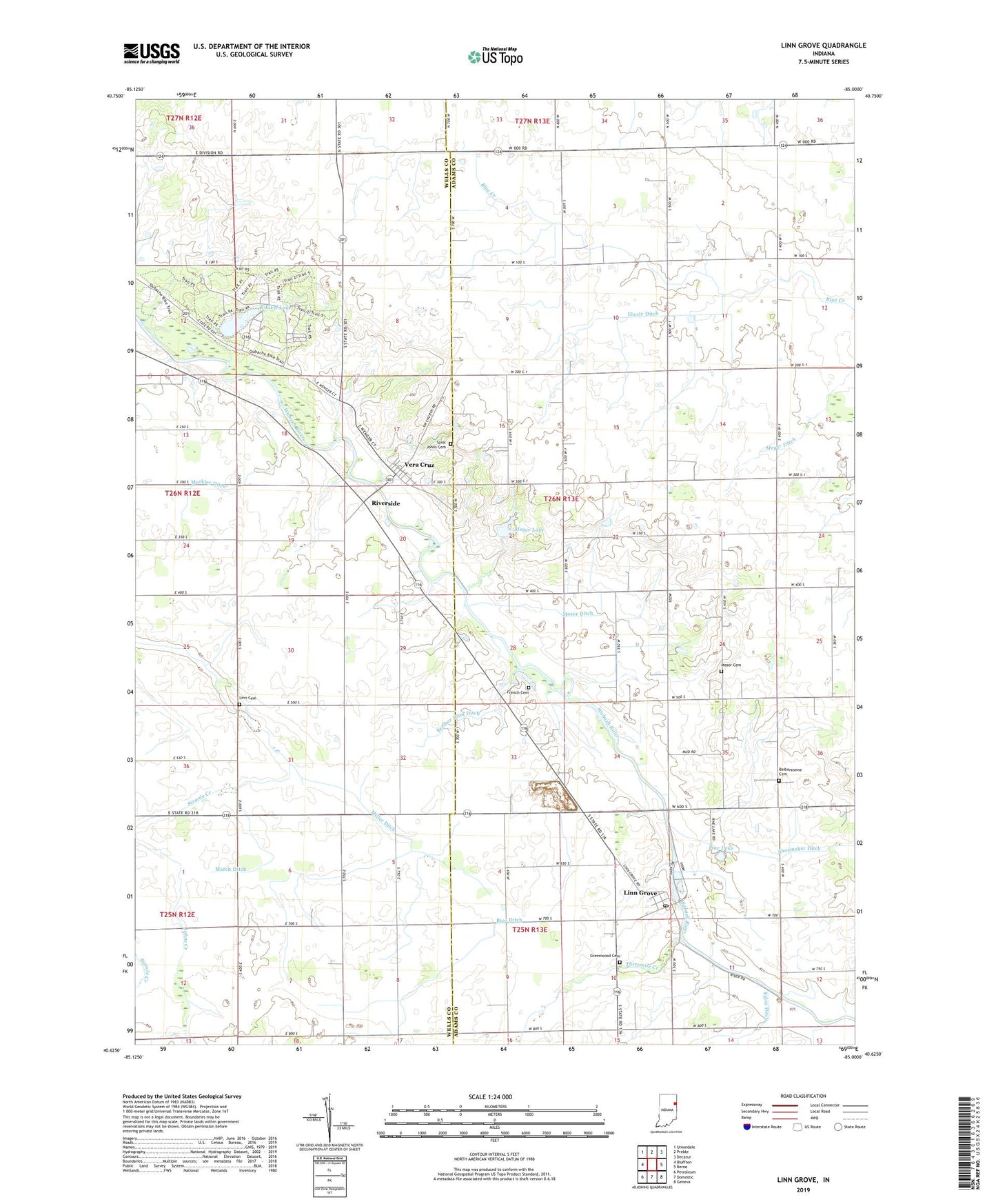
2022 topographic map quadrangle Linn Grove in the state of Indiana. Scale: 1:24000. Based on the newly updated USGS 7.5' US Topo map series, this map is in the following counties: Adams, Wells. The map contains contour data, water features, and other items you are used to seeing on USGS maps, but also has updated roads and other features. This is the next generation of topographic maps. Printed on high-quality waterproof paper with UV fade-resistant inks.
Quads adjacent to this one:
West: Bluffton
Northwest: Uniondale
North: Preble
Northeast: Decatur
East: Berne
Southeast: Geneva
South: Domestic
Southwest: Petroleum
This map covers the same area as the classic USGS quad with code o40085f1.
Contains the following named places: B and R Farms, Beibersteine Cemetery, Breiner Joint Ditch, French Cemetery, Greenwood Cemetery, Hierly Ditch, Kunkel Lake, Linn Cemetery, Linn Grove, Linn Grove Post Office, Linn Grove Quarry, March Ditch, Markley Ditch, Meyer Ditch, Meyer Lake, Miller Ditch, Moser Cemetery, Moser Ditch, Old Salem Church, Ouabache State Park, Pine Lake, Rice Ditch, Riverside, S and G Poultry Farm, Saint Johns Cemetery, Shoemaker Ditch, Solid Rock Farms, South Forty Farms, Sullivan Ditch, Threemile Creek, Town of Vera Cruz, Township of French, Tri Oaks Farm, Vera Cruz, West Missionary Church