MyTopo
Pierceville Indiana US Topo Map
Couldn't load pickup availability
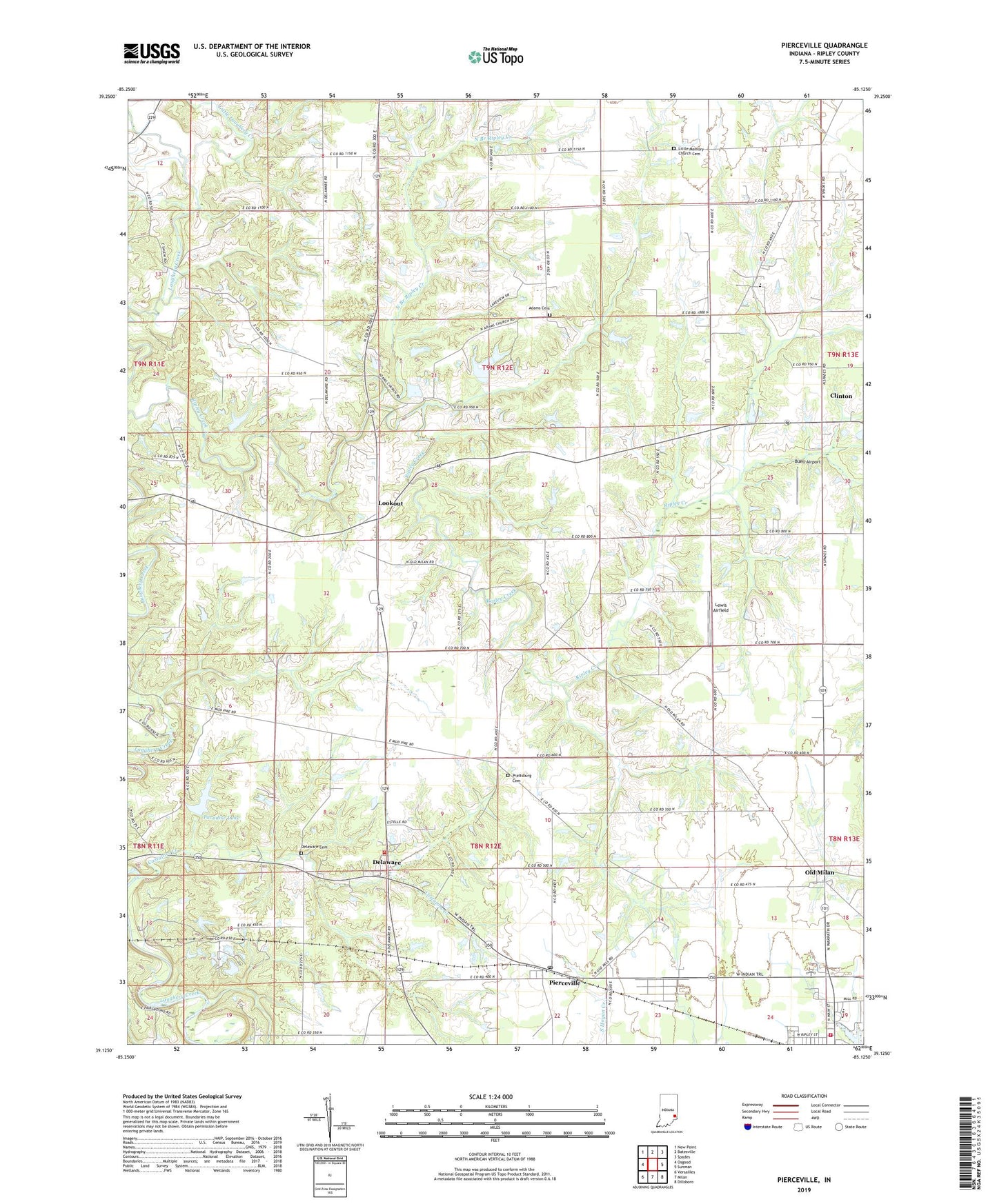
2022 topographic map quadrangle Pierceville in the state of Indiana. Scale: 1:24000. Based on the newly updated USGS 7.5' US Topo map series, this map is in the following counties: Ripley. The map contains contour data, water features, and other items you are used to seeing on USGS maps, but also has updated roads and other features. This is the next generation of topographic maps. Printed on high-quality waterproof paper with UV fade-resistant inks.
Quads adjacent to this one:
West: Osgood
Northwest: New Point
North: Batesville
Northeast: Spades
East: Sunman
Southeast: Dillsboro
South: Milan
Southwest: Versailles
This map covers the same area as the classic USGS quad with code o39085b2.
Contains the following named places: Adams Cemetery, Adams Church, Behlmer Corner, Broughton Lake, Broughton Lake Dam, Buell Airport, Castators Creek, Clinton, Delaware, Delaware Cemetery, Delaware Community Volunteer Fire Department, La Sarre Lake Dam, Laughery Bridge Church, Laughery Switch, Lewis Airfield, Little Laughery Creek, Little Memory Church Cemetery, Lookout, Melissaville, Milan Junior and Senior High School, Milan Volunteer Fire Department, Mud Pike Church, North Branch Ripley Creek, Old Milan, Paradise Lake, Pierceville, Pierceville Post Office, Prattsburg, Prattsburg Cemetery, Ripley County Emergency Medical Services, Saint Nicholas School, Saint Pauls Church, Saint Pius Church, Stumpke Corner, Town of Milan, Township of Delaware, Township of Franklin