MyTopo
Waldron Indiana US Topo Map
Couldn't load pickup availability
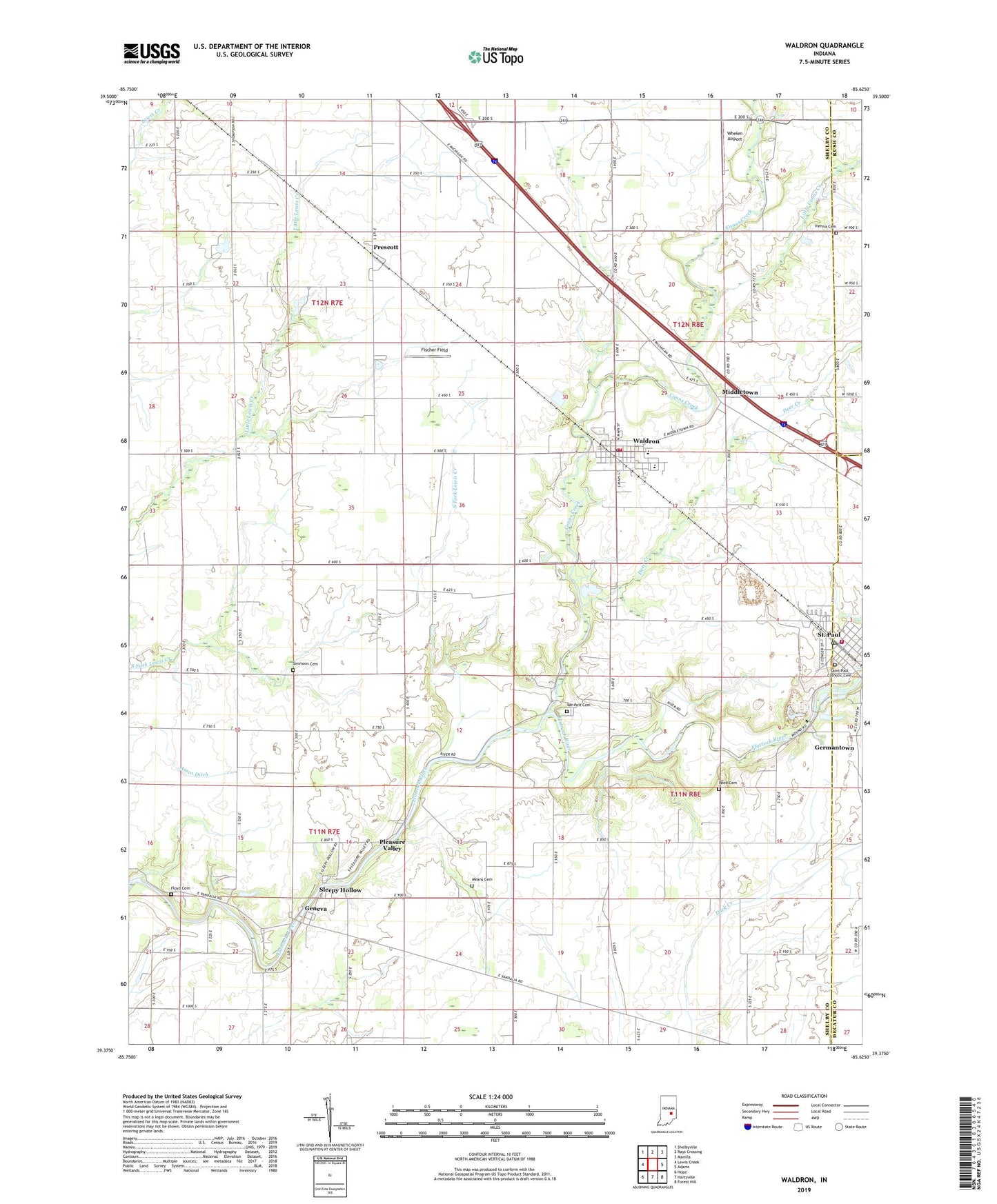
2022 topographic map quadrangle Waldron in the state of Indiana. Scale: 1:24000. Based on the newly updated USGS 7.5' US Topo map series, this map is in the following counties: Shelby, Decatur, Rush. The map contains contour data, water features, and other items you are used to seeing on USGS maps, but also has updated roads and other features. This is the next generation of topographic maps. Printed on high-quality waterproof paper with UV fade-resistant inks.
Quads adjacent to this one:
West: Lewis Creek
Northwest: Shelbyville
North: Rays Crossing
Northeast: Manilla
East: Adams
Southeast: Forest Hill
South: Hartsville
Southwest: Hope
This map covers the same area as the classic USGS quad with code o39085d6.
Contains the following named places: Blue Ridge, Blue Ridge Post Office, Camp Flat Rock, Conns Creek, Deer Creek, Fischer Field, Floyd Cemetery, Geneva, Germantown, Little Conns Creek, Means Cemetery, Middletown, Morven, Pleasant Hill Church, Pleasure Valley, Prescott, Reed Cemetery, Saint Paul, Saint Paul Catholic Cemetery, Saint Paul Police Department, Saint Paul Post Office, Saint Paul Quarry, Saint Paul Volunteer Fire Department, Saint Vincent School, Simmons Cemetery, Sleepy Hollow, Town of Saint Paul, Township of Liberty, Township of Noble, Valley Church, Van Pelt Cemetery, Vienna Cemetery, Waldron, Waldron Census Designated Place, Waldron Elementary School, Waldron Junior-Senior High School, Waldron Post Office, Waldron Volunteer Fire Department, Wesley Chapel, Whelen Airport, ZIP Code: 46182