MyTopo
Adams Indiana US Topo Map
Couldn't load pickup availability
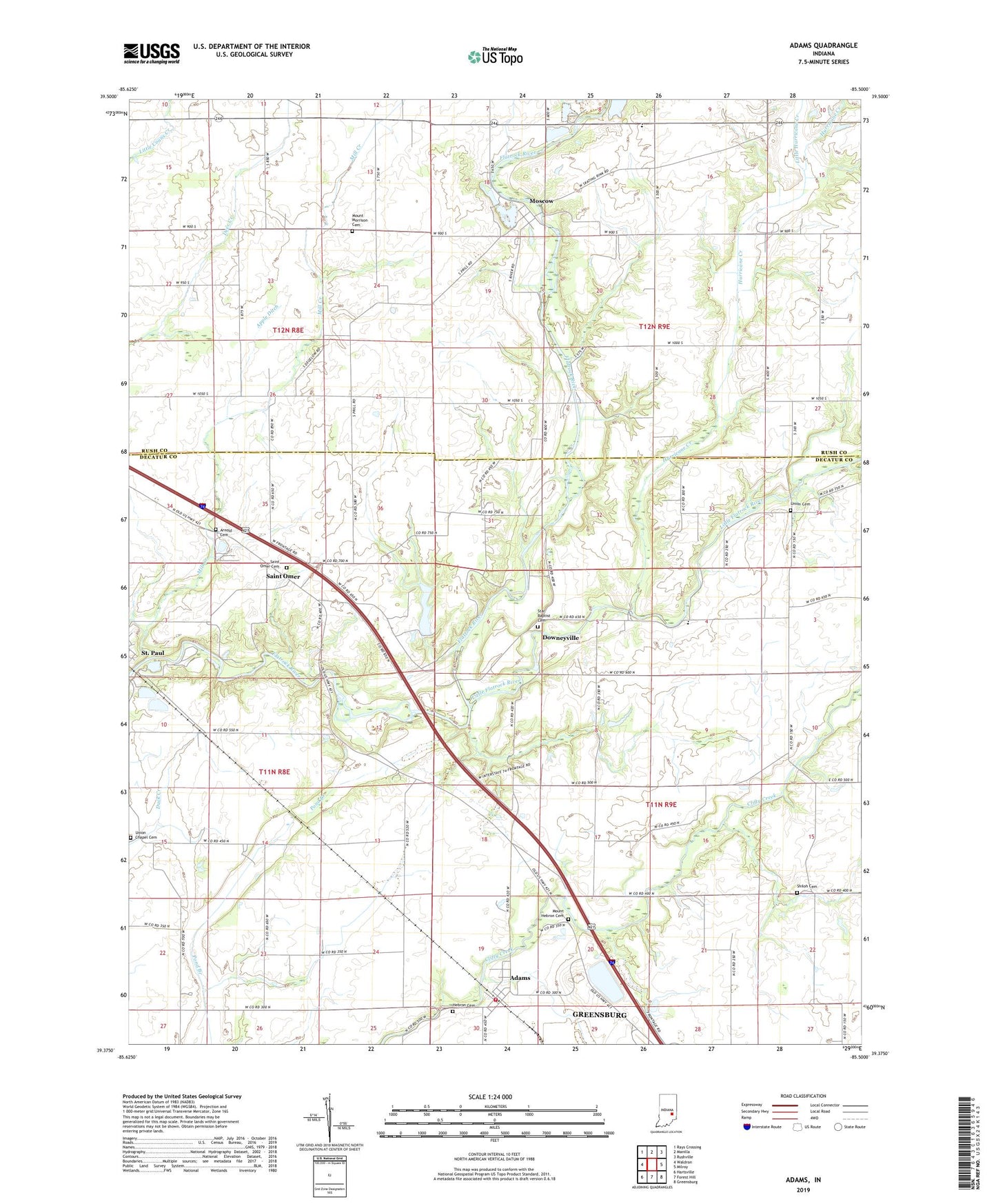
2022 topographic map quadrangle Adams in the state of Indiana. Scale: 1:24000. Based on the newly updated USGS 7.5' US Topo map series, this map is in the following counties: Decatur, Rush. The map contains contour data, water features, and other items you are used to seeing on USGS maps, but also has updated roads and other features. This is the next generation of topographic maps. Printed on high-quality waterproof paper with UV fade-resistant inks.
Quads adjacent to this one:
West: Waldron
Northwest: Rays Crossing
North: Manilla
Northeast: Rushville
East: Milroy
Southeast: Greensburg
South: Forest Hill
Southwest: Hartsville
This map covers the same area as the classic USGS quad with code o39085d5.
Contains the following named places: Adams, Adams Fire Department, Adams Township Volunteer Fire Department, Apple Ditch, Arnold Cemetery, Downeyville, Hebron Cemetery, Hurricane Creek, Little Flatrock River, Little Hurricane Creek, Mill Creek, Moscow, Mount Hebron Cemetery, Mount Morrison Cemetery, Saint Omer, Saint Omer Cemetery, Shiloh Cemetery, Star Baptist Cemetery, Star Church, Township of Adams, Township of Orange, Union Cemetery, Union Chapel, Union Chapel Cemetery, ZIP Code: 47272