MyTopo
Redkey Indiana US Topo Map
Couldn't load pickup availability
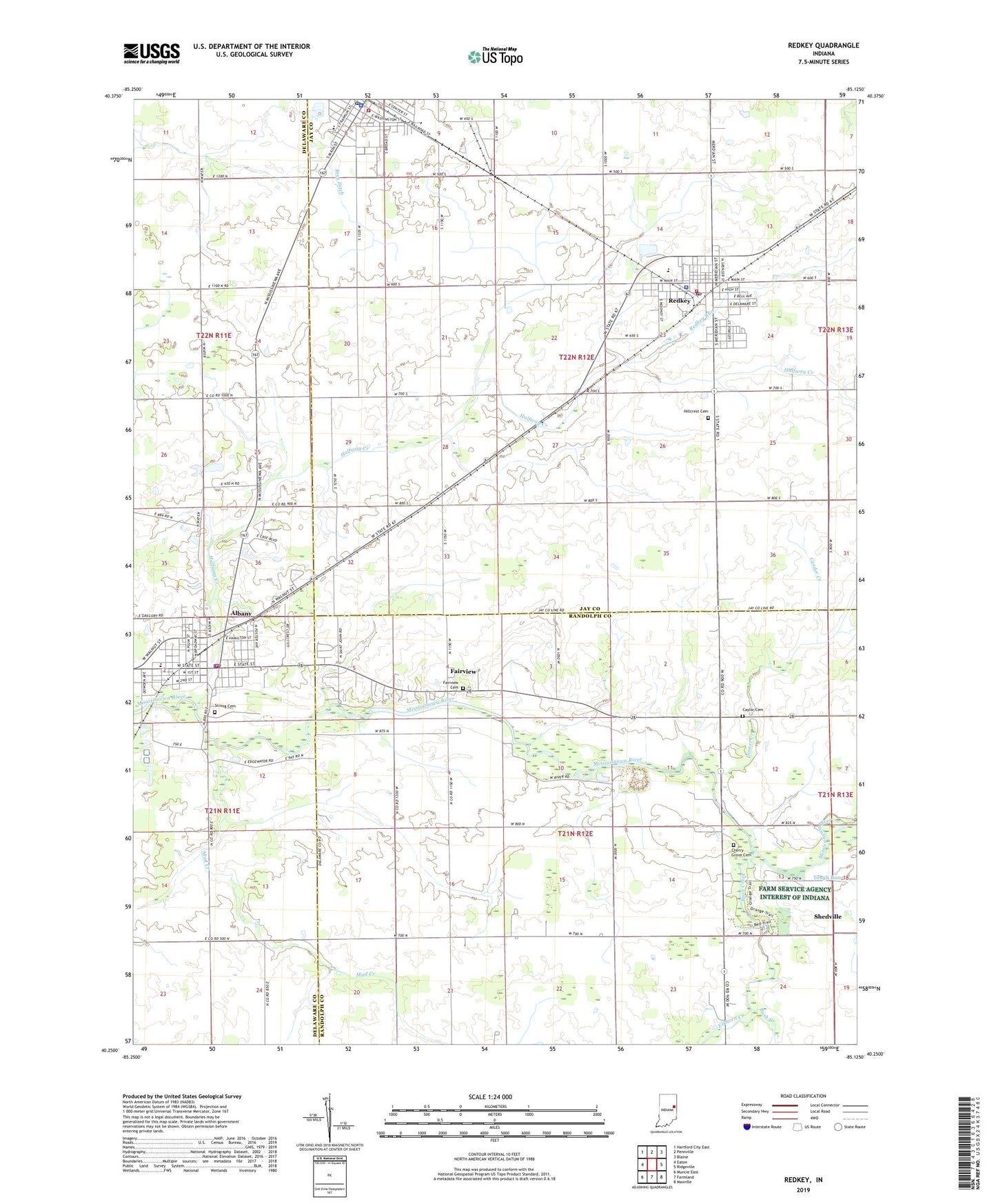
2022 topographic map quadrangle Redkey in the state of Indiana. Scale: 1:24000. Based on the newly updated USGS 7.5' US Topo map series, this map is in the following counties: Randolph, Jay, Delaware. The map contains contour data, water features, and other items you are used to seeing on USGS maps, but also has updated roads and other features. This is the next generation of topographic maps. Printed on high-quality waterproof paper with UV fade-resistant inks.
Quads adjacent to this one:
West: Eaton
Northwest: Hartford City East
North: Pennville
Northeast: Blaine
East: Ridgeville
Southeast: Maxville
South: Farmland
Southwest: Muncie East
This map covers the same area as the classic USGS quad with code o40085c2.
Contains the following named places: Albany, Albany - Delaware Township Volunteer Fire Department, Albany Elementary School, Albany Emergency Medical Services, Albany Fire Department, Albany Police Department, Albany Post Office, Bethel Church, Bush Creek, Carder Creek, Caylor Cemetery, Cherry Grove Cemetery, City of Dunkirk, Community Church, Dinner Creek, Dunkirk Police Department, Dunkirk Post Office, Elkhorn Creek, Fairview, Fairview Cemetery, Flesher Farms, Halfway Creek, Hillcrest Cemetery, Mud Creek, Purdue University Agriculture Station, Redkey, Redkey Police Dept, Redkey Post Office, Redkey Run, Redkey Volunteer Fire Department, Saint Marys Church, Shedville, Strong Cemetery, Sugar Grove Church, Sutton School, Tough Run, Town of Albany, Town of Redkey, Township of Green, Township of Richland, Triumph Church, ZIP Code: 47373