MyTopo
Ridgeville Indiana US Topo Map
Couldn't load pickup availability
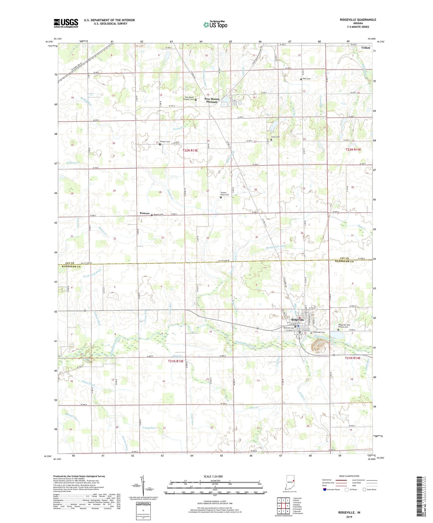
2022 topographic map quadrangle Ridgeville in the state of Indiana. Scale: 1:24000. Based on the newly updated USGS 7.5' US Topo map series, this map is in the following counties: Randolph, Jay. The map contains contour data, water features, and other items you are used to seeing on USGS maps, but also has updated roads and other features. This is the next generation of topographic maps. Printed on high-quality waterproof paper with UV fade-resistant inks.
Quads adjacent to this one:
West: Redkey
Northwest: Pennville
North: Blaine
Northeast: Portland
East: Deerfield
Southeast: Winchester
South: Maxville
Southwest: Farmland
This map covers the same area as the classic USGS quad with code o40085c1.
Contains the following named places: Bear Creek, Bost Cemetery, Bost Run, Days Creek, De Armond Ditch, Deer Ridge Farm, Deerfield Elementary School, Edwards Farms, Emmetsville Church, Fetid Creek, Finch Cemetery, Flesher Cemetery, Flesher Creek, Flower Point Cemetery, Friend Run, Great Run, Heuss Ditch, Jeff Run, Mendenhall Ditch, Miller Ditch, Mississinewa Church, New Mount Pleasant, New Mount Pleasant Cemetery, Pleasant Vale Church, Polar Run, Potent Run, Powers, Powers Cemetery, Randolph Church, Rank Run, Red Key Sow Farm, Retter Farms, Ridge Run, Ridgeview Odd Fellows Cemetery, Ridgeville, Ridgeville Elevator, Ridgeville Fire Department, Ridgeville Police Department, Ridgeville Post Office, Riverside Cemetery, Smithson Farms, Stevens Ditch, Town of Ridgeville, Township of Franklin, Township of Jefferson, Uphaus Ditch, Vale Run, Veterans Cemetery, Ville Run, Virile Run, WILO-AM (New Albany), Windy P Ridge Airport, ZIP Code: 47380