MyTopo
Ripley Indiana US Topo Map
Couldn't load pickup availability
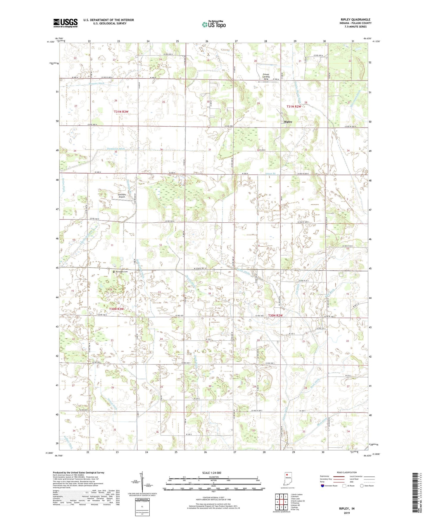
2022 topographic map quadrangle Ripley in the state of Indiana. Scale: 1:24000. Based on the newly updated USGS 7.5' US Topo map series, this map is in the following counties: Pulaski. The map contains contour data, water features, and other items you are used to seeing on USGS maps, but also has updated roads and other features. This is the next generation of topographic maps. Printed on high-quality waterproof paper with UV fade-resistant inks.
Quads adjacent to this one:
West: North Judson SE
Northwest: North Judson
North: Denham
Northeast: Bass Lake
East: Winamac
Southeast: Star City
South: Buffalo
Southwest: Monon NE
This map covers the same area as the classic USGS quad with code o41086a6.
Contains the following named places: Agnew Branch, Agnew Ditch, Aurora School, Bethel Church, Bouslog Branch, Budd Fisher Ditch, Burroughs Cemetery, Cox Ditch, Dilts Anstis Ditch, Dressler Ditch, Dutton Ditch, Graves Landing Strip, Hathaway Ditch, Hoch Ditch, Hoover Ditch, Hunter Branch, Moss Creek Country Club, Moss Ditch, Pifer Ditch, Pulaski County, Quigley Marsh Ditch, Ripley, Smith Ditch, Sommers Airport, Thompson Branch, Thompson Ditch, Township of Monroe, Wallace Ditch, ZIP Code: 46996