MyTopo
Hartford City West Indiana US Topo Map
Couldn't load pickup availability
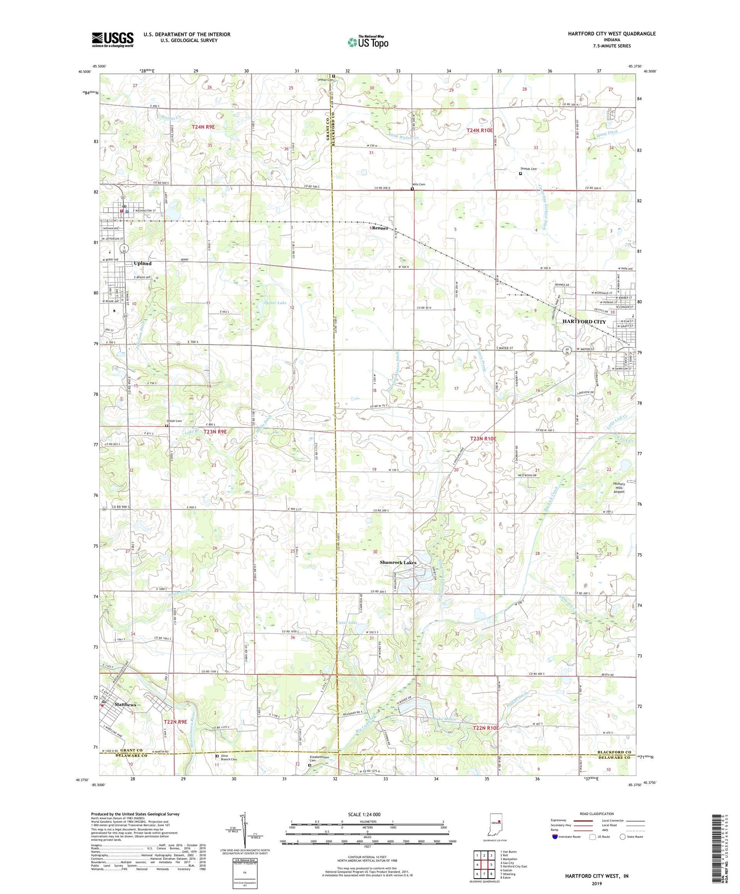
2022 topographic map quadrangle Hartford City West in the state of Indiana. Scale: 1:24000. Based on the newly updated USGS 7.5' US Topo map series, this map is in the following counties: Blackford, Grant, Delaware. The map contains contour data, water features, and other items you are used to seeing on USGS maps, but also has updated roads and other features. This is the next generation of topographic maps. Printed on high-quality waterproof paper with UV fade-resistant inks.
Quads adjacent to this one:
West: Gas City
Northwest: Van Buren
North: Roll
Northeast: Montpelier
East: Hartford City East
Southeast: Eaton
South: Wheeling
Southwest: Gaston
This map covers the same area as the classic USGS quad with code o40085d4.
Contains the following named places: Bethel Center Church, Big Lick Creek, Cains Lake, Dollar Lake, Elizabethtown Cemetery, Fiddler Ditch, Grant County Emergency Medical Services - Matthews Medic 10, Hollis Ditch, Hoovers Airport, Inman Airport, Jefferson Ditch, Lake Mohee, Lake Mohee Dam, Leffler Cemetery, Little Joe Creek, Little Lick Creek, Little Walnut Creek, Matthews, Matthews Post Office, Matthews Volunteer Fire Department, Miller Purdue Agricultural Center, Mills Cemetery, Monroe Prairie Creek, Moore Prong, Olive Branch Cemetery, Parkside Elementary School, Pleasant Grove Church, Purdue University Memorial Farm, Renner, Shamrock Lakes, Shields Cemetery, Shiloh Cemetery, Smith Ditch, Taylor University, Town of Matthews, Town of Shamrock Lakes, Townsand Lucas Ditch, Township of Licking, Union Church, Upland, Upland Community Church, Upland Elementary and Middle School, Upland Police Department, Upland Post Office, Upland Volunteer Fire Department, ZIP Codes: 46957, 46989