MyTopo
Gas City Indiana US Topo Map
Couldn't load pickup availability
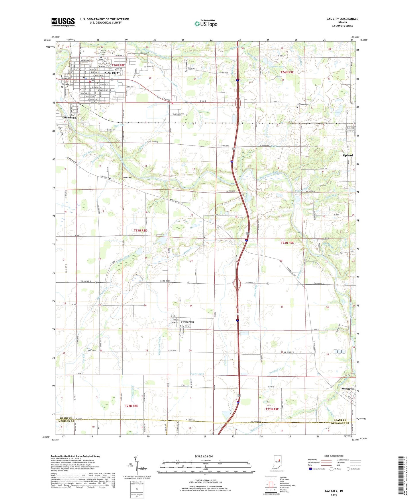
2022 topographic map quadrangle Gas City in the state of Indiana. Scale: 1:24000. Based on the newly updated USGS 7.5' US Topo map series, this map is in the following counties: Grant, Delaware, Madison. The map contains contour data, water features, and other items you are used to seeing on USGS maps, but also has updated roads and other features. This is the next generation of topographic maps. Printed on high-quality waterproof paper with UV fade-resistant inks.
Quads adjacent to this one:
West: Fairmount
Northwest: Marion
North: Van Buren
Northeast: Roll
East: Hartford City West
Southeast: Wheeling
South: Gaston
Southwest: Alexandria
This map covers the same area as the classic USGS quad with code o40085d5.
Contains the following named places: Ball Run, Bean Run, Bethel Cemetery, Branch Creek, Cane Run, City of Gas City, City Run, Crawford Creek, East Elementary School, Ethel Run, Fowler Ditch, Fowlerton, Fowlerton Drain, Galatia Ditch, Gas City, Gas City Fire Department Station 1, Gas City Police Department, Gas City Post Office, Grant County Emergency Medical Services - Gas City Medic 9 and 12, Harmony Church, Hopcus Run, Hoppas Ditch, Hyer Ditch, Janney Run, Jefferson Cemetery, Jefferson Church, Lake Branch, Long Branch, Mat Run, Matthews Elementary School, Mississinewa High School, New Prairie Creek, Octain Creek, R J Baskett Middle School, Regular Run, Riverside Cemetery, Round Run, Shady Lawn Hog Farm, Shell Run, Sports Lake, Sports Lake Dam, Sports Run, Town of Fowlerton, Town of Upland, Township of Fairmount, Township of Jefferson, Township of Mill, Upland Drain, Van Run, Walnut Creek Cemetery, ZIP Codes: 46930, 46933