MyTopo
Wingate Indiana US Topo Map
Couldn't load pickup availability
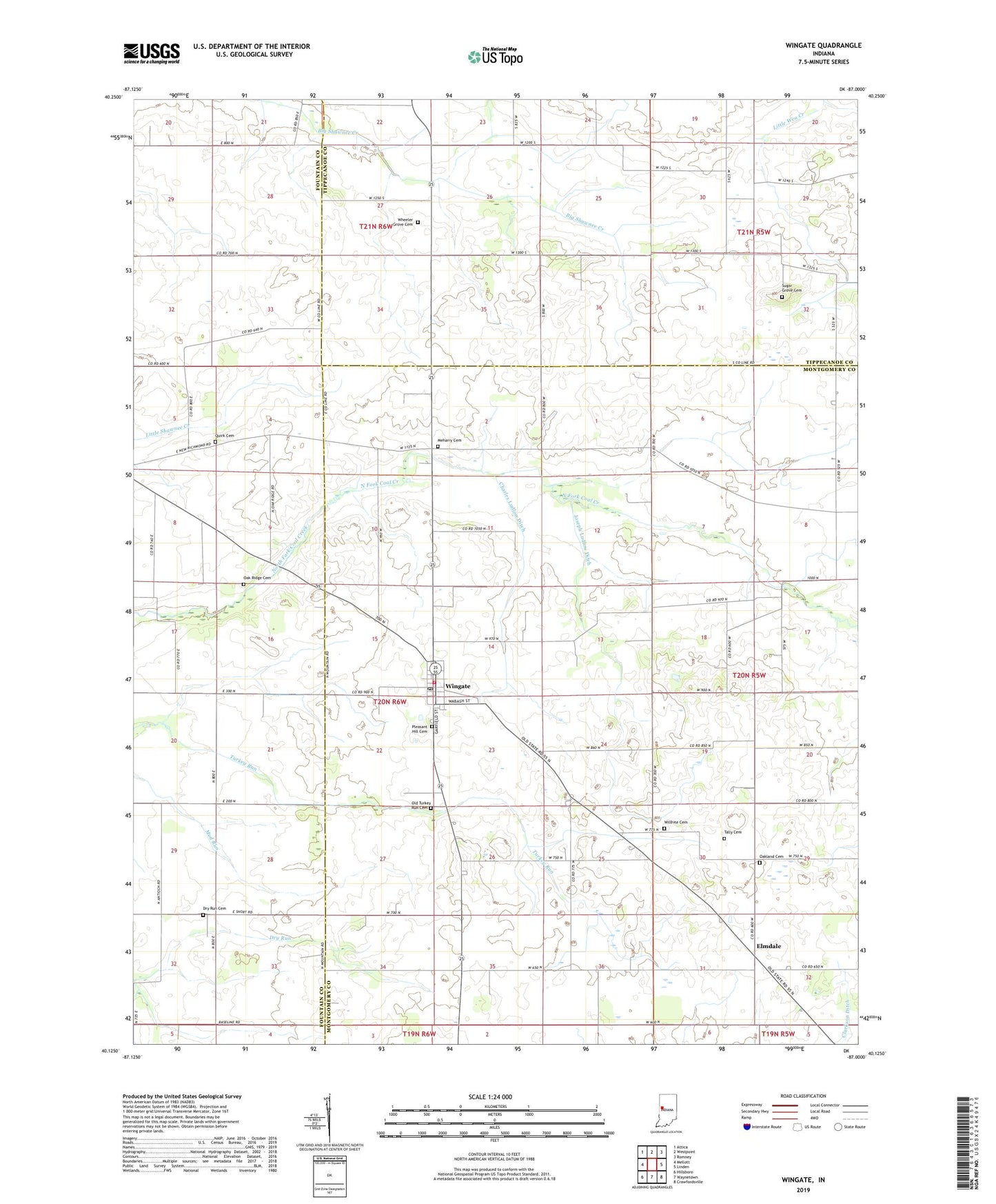
2022 topographic map quadrangle Wingate in the state of Indiana. Scale: 1:24000. Based on the newly updated USGS 7.5' US Topo map series, this map is in the following counties: Montgomery, Fountain, Tippecanoe. The map contains contour data, water features, and other items you are used to seeing on USGS maps, but also has updated roads and other features. This is the next generation of topographic maps. Printed on high-quality waterproof paper with UV fade-resistant inks.
Quads adjacent to this one:
West: Mellott
Northwest: Attica
North: Westpoint
Northeast: Romney
East: Linden
Southeast: Crawfordsville
South: Waynetown
Southwest: Hillsboro
This map covers the same area as the classic USGS quad with code o40087b1.
Contains the following named places: Babcocks Airport, Center Church, Charles Ludlow Ditch, Coal Creek Central School, Coal Creek Township Volunteer Fire Department, Dry Run Cemetery, Elmdale, Joseph Ludlow Ditch, Meharry AG Service Airport, Meharry Cemetery, Oak Ridge Cemetery, Oakland Cemetery, Old Turkey Run Cemetery, Pleasant Hill Cemetery, Quirk Cemetery, Sugar Grove Cemetery, Town of Wingate, Townsend Airport, Township of Coal Creek, Wheeler Grove Cemetery, Willhite Cemetery, Wingate, Wingate Post Office, Wolf Creek, ZIP Codes: 47967, 47994