MyTopo
Salem Indiana US Topo Map
Couldn't load pickup availability
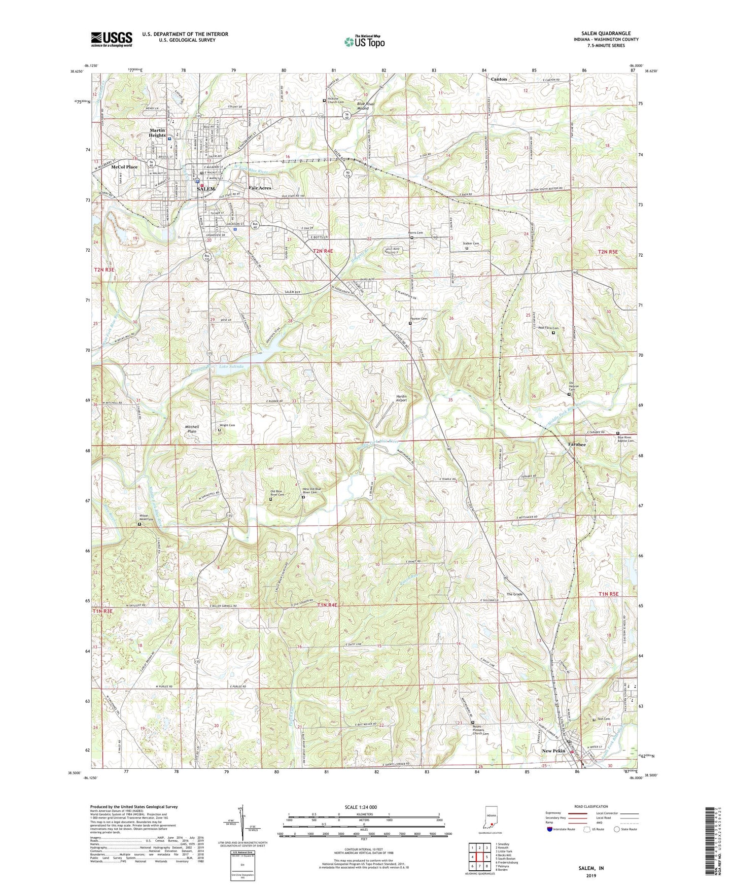
2022 topographic map quadrangle Salem in the state of Indiana. Scale: 1:24000. Based on the newly updated USGS 7.5' US Topo map series, this map is in the following counties: Washington. The map contains contour data, water features, and other items you are used to seeing on USGS maps, but also has updated roads and other features. This is the next generation of topographic maps. Printed on high-quality waterproof paper with UV fade-resistant inks.
Quads adjacent to this one:
West: Becks Mill
Northwest: Smedley
North: Kossuth
Northeast: Little York
East: South Boston
Southeast: Borden
South: Palmyra
Southwest: Fredericksburg
This map covers the same area as the classic USGS quad with code o38086e1.
Contains the following named places: Ascension Saint Vincent Salem Hospital, Blue River Baptist Cemetery, Blue River Church, Blue River Mound, Canton, City of Salem, Fair Acres, Farabee, Hardin Airport, Harristown, Hicksite Church Cemetery, Hoggatt Branch, Lake Salinda, Martin Heights, McCol Place, Mount Pleasant Church, Mount Pleasant Church Cemetery, New Old Blue River Cemetery, New Pekin, Norris Cemetery, Old Blue River Cemetery, Old Blue River Friends Church, Old Hebron Cemetery, Paynter Cemetery, Pekin Post Office, Pierce - Polk Township Volunteer Fire Department, Pierce Consolidated School, Poor Farm Cemetery, Salem, Salem Fire Department, Salem Police Department, Salem Post Office, Salem Quarry, Stalker Cemetery, Tash Cemetery, The Grade, Town of New Pekin, Township of Pierce, Township of Washington, Washington County, Washington County Sheriff's Office, West Fork Blue River, Wilson - Mead Cemetery, Wright Cemetery, WSLM-AM (Salem), WSLM-FM, ZIP Codes: 47165, 47167