MyTopo
South Boston Indiana US Topo Map
Couldn't load pickup availability
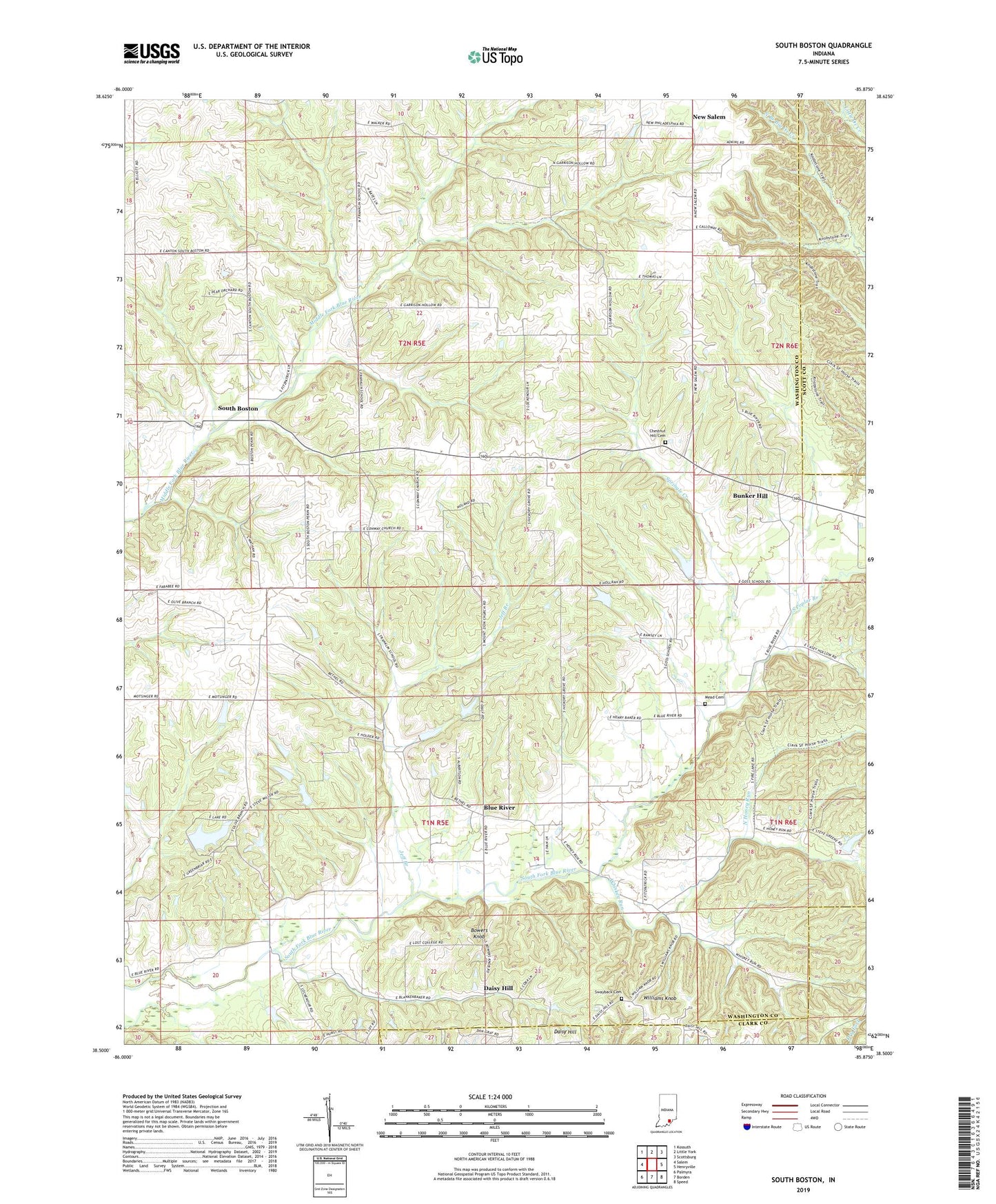
2022 topographic map quadrangle South Boston in the state of Indiana. Scale: 1:24000. Based on the newly updated USGS 7.5' US Topo map series, this map is in the following counties: Washington, Scott, Clark. The map contains contour data, water features, and other items you are used to seeing on USGS maps, but also has updated roads and other features. This is the next generation of topographic maps. Printed on high-quality waterproof paper with UV fade-resistant inks.
Quads adjacent to this one:
West: Salem
Northwest: Kossuth
North: Little York
Northeast: Scottsburg
East: Henryville
Southeast: Speed
South: Borden
Southwest: Palmyra
This map covers the same area as the classic USGS quad with code o38085e8.
Contains the following named places: Bartle, Blue River, Bowers Knob, Bunker Hill, Bunker Hill Church, Chestnut Hill Cemetery, Chestnut Hill Post Office, Clark State Forest, Conoway Church, Daisy Hill, Franklin School, Honey Run, Jeff Branch, Lockwood Branch, Mead Cemetery, Mount Bethel Church, Mount Zion Church, New Salem, North Honey Run, Olive Branch Church, Peek-A-Boo Lake, Peek-A-Boo Lake Dam, Polk School, South Boston, South Poplar Branch, Springle Creek, Swayback Cemetery, Township of Franklin, Township of Polk, Whiskey Run, Williams Knob