MyTopo
Hymera Indiana US Topo Map
Couldn't load pickup availability
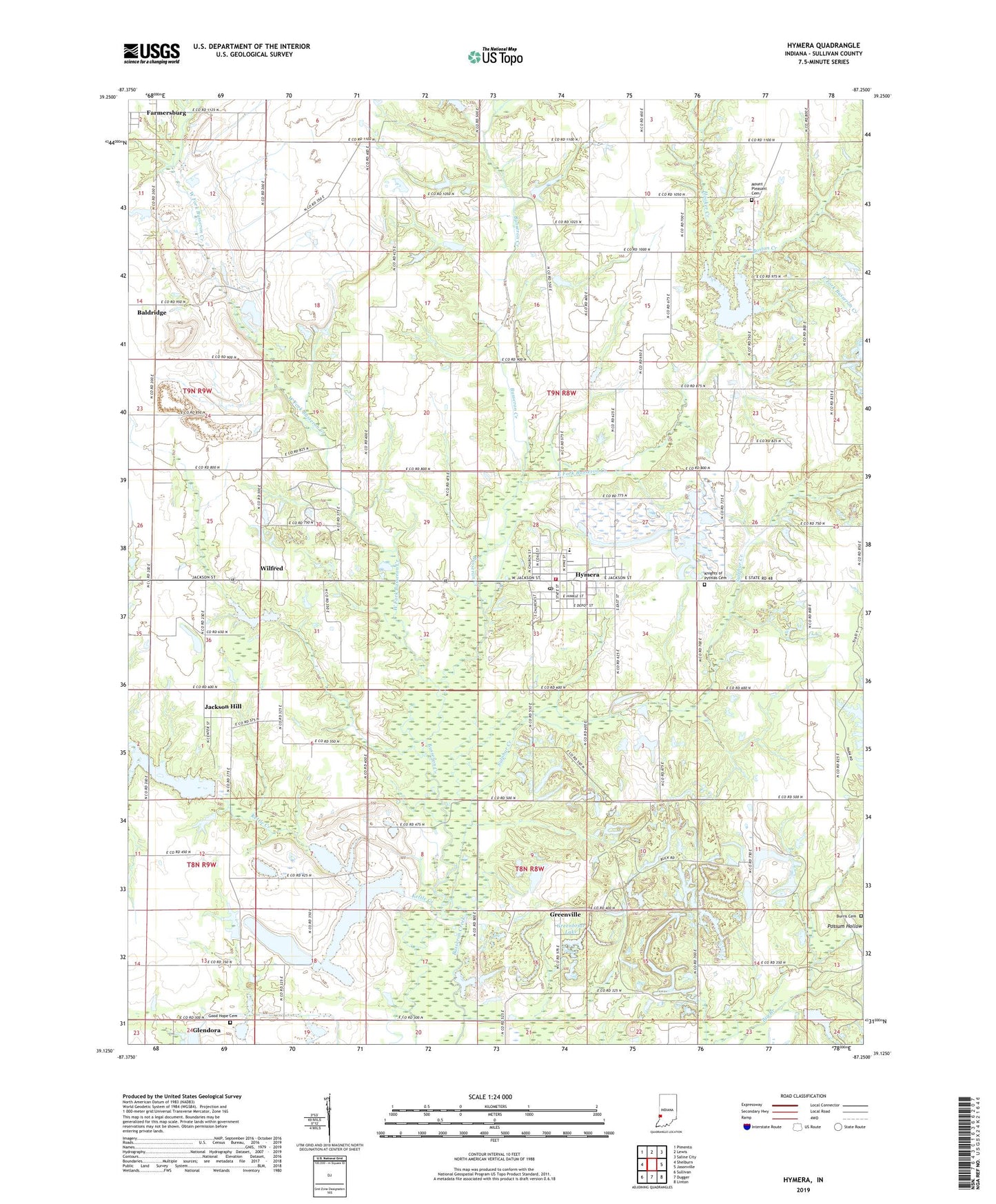
2022 topographic map quadrangle Hymera in the state of Indiana. Scale: 1:24000. Based on the newly updated USGS 7.5' US Topo map series, this map is in the following counties: Sullivan. The map contains contour data, water features, and other items you are used to seeing on USGS maps, but also has updated roads and other features. This is the next generation of topographic maps. Printed on high-quality waterproof paper with UV fade-resistant inks.
Quads adjacent to this one:
West: Shelburn
Northwest: Pimento
North: Lewis
Northeast: Saline City
East: Jasonville
Southeast: Linton
South: Dugger
Southwest: Sullivan
This map covers the same area as the classic USGS quad with code o39087b3.
Contains the following named places: Austin Air Ads Airport, Baker, Baldridge, Boston Creek, Burris Cemetery, Busseron Dam Number D-9, Busseron Dam Number F-2, Busseron Dam Number G-5, Busseron Dam Number I-2, Claiborne Church, East Fork Busseron Creek, Glendora, Good Hope Cemetery, Greenbriar Lake, Greenville, Hamilton Pond, Hawton, Hooker Creek, Hymera, Hymera Elementary School, Hymera Emergency Response Team, Hymera Post Office, Hymera Volunteer Fire Department, Jackson Hill, Knights of Pythias Cemetery, Mount Pleasant Cemetery, Nye Chapel, Oak Grove Church, Palmers Prairie Church, Shiloh Church, Sugar Grove Church, Sulphur Creek, Town of Hymera, Township of Jackson, West Fork Busseron Creek, Wilfred, ZIP Code: 47855