MyTopo
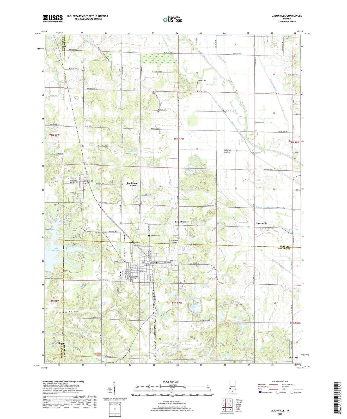
Jasonville Indiana US Topo Map
Couldn't load pickup availability
2022 topographic map quadrangle Jasonville in the state of Indiana. Scale: 1:24000. Based on the newly updated USGS 7.5' US Topo map series, this map is in the following counties: Clay, Greene, Sullivan. The map contains contour data, water features, and other items you are used to seeing on USGS maps, but also has updated roads and other features. This is the next generation of topographic maps. Printed on high-quality waterproof paper with UV fade-resistant inks.
Quads adjacent to this one:
West: Hymera
Northwest: Lewis
North: Saline City
Northeast: Clay City
East: Coal City
Southeast: Switz City
South: Linton
Southwest: Dugger
This map covers the same area as the classic USGS quad with code o39087b2.
Contains the following named places: Bennington Lake, Boat Lake, Bogle Corner, Buchanan Corner, Busseron Dam Number D-4, Care Ambulance Service, City of Jasonville, Coalmont, Coalmont Census Designated Place, Coalmont Post Office, Coffee Post Office, Eel River Prairie, Friendly Grove Church, Gilmour, Hickory Lake, Howesville, Jason Lake Dam, Jasonville, Jasonville Police Department, Jasonville Post Office, Jasonville Volunteer Fire Department, Lake Kickapoo, Lake Lenape, Lake Shakamak, Lateral Number Four, Latta Yard, Lebanon Cemetery, Lebanon Church, Lewis Township Fire Company, Little Flock Church, Lone Tree, New Wilson Church, Oak Grove Cemetery, Old Union Cemetery, Possum Hollow, Powell Pond, Redcuff Corner, Sanders Cemetery, Shakamak Airport, Shakamak Elementary School, Shakamak High School, Shakamak Lake Dam, Shakamak Middle School, Shakamak State Park, Township of Lewis, Township of Wright, ZIP Code: 47438