MyTopo
Solsberry Indiana US Topo Map
Couldn't load pickup availability
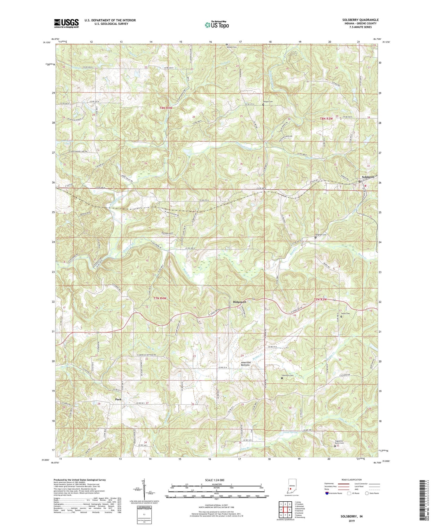
2022 topographic map quadrangle Solsberry in the state of Indiana. Scale: 1:24000. Based on the newly updated USGS 7.5' US Topo map series, this map is in the following counties: Greene. The map contains contour data, water features, and other items you are used to seeing on USGS maps, but also has updated roads and other features. This is the next generation of topographic maps. Printed on high-quality waterproof paper with UV fade-resistant inks.
Quads adjacent to this one:
West: Bloomfield
Northwest: Arney
North: Freedom
Northeast: Whitehall
East: Stanford
Southeast: Owensburg
South: Koleen
Southwest: Scotland
This map covers the same area as the classic USGS quad with code o39086a7.
Contains the following named places: American Bottoms, Anderson Branch, Augustine Burch Cemetery, Beech Creek, Beechwood Lake Dam, Bingham Cemetery, Bridge Creek, Camp Creek, Combs School, Dry Branch, Eastern Volunteer Fire Department, Goad Spring, Lawrence Cemetery, Mount Calvary Church, Newark Cemetery, Ore Branch Church, Park, Philpot Cemetery, Ridgeport, Ridgeport Church, Sharkey Church, Solsberry, Solsberry Post Office, Stone Cemetery, Sylvania Church, Tanner, Township of Beech Creek, Township of Center, Walnut Church