MyTopo
Arney Indiana US Topo Map
Couldn't load pickup availability
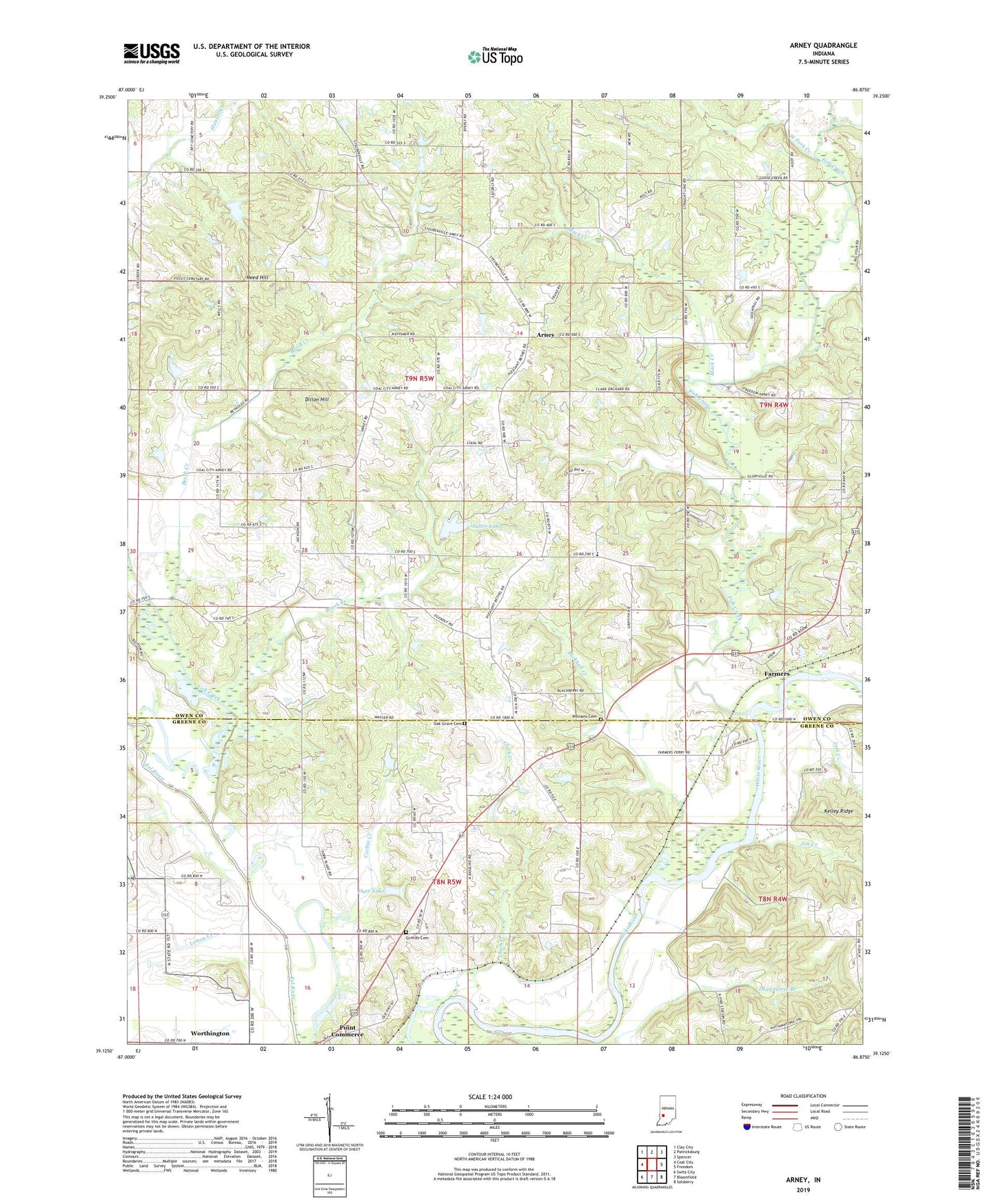
2022 topographic map quadrangle Arney in the state of Indiana. Scale: 1:24000. Based on the newly updated USGS 7.5' US Topo map series, this map is in the following counties: Owen, Greene. The map contains contour data, water features, and other items you are used to seeing on USGS maps, but also has updated roads and other features. This is the next generation of topographic maps. Printed on high-quality waterproof paper with UV fade-resistant inks.
Quads adjacent to this one:
West: Coal City
Northwest: Clay City
North: Patricksburg
Northeast: Spencer
East: Freedom
Southeast: Solsberry
South: Bloomfield
Southwest: Switz City
This map covers the same area as the classic USGS quad with code o39086b8.
Contains the following named places: Antioch Church, Arney, Beech Creek, Brush Creek, Buckhall Creek, Corbin Creek, Dillon Hill, Dutch Bethel Church, Dyer Lake, Dyer Lake Dam, Farmers, Farmers Ferry, Fish Creek, Goose Creek, Griffith Cemetery, Jack Creek, Jim Creek, Lemon Creek, Lick Creek, Little John Cemetery, Mack Creek, Need Hill, Oak Grove Cemetery, Pleasant Bethel Church, Point Commerce, Salter Lake, Salter Lake Dam, Township of Jefferson, Von Sloughs Airport, West Fork Creek, Williams Cemetery, Worthington, ZIP Code: 47431