MyTopo
Whitehall Indiana US Topo Map
Couldn't load pickup availability
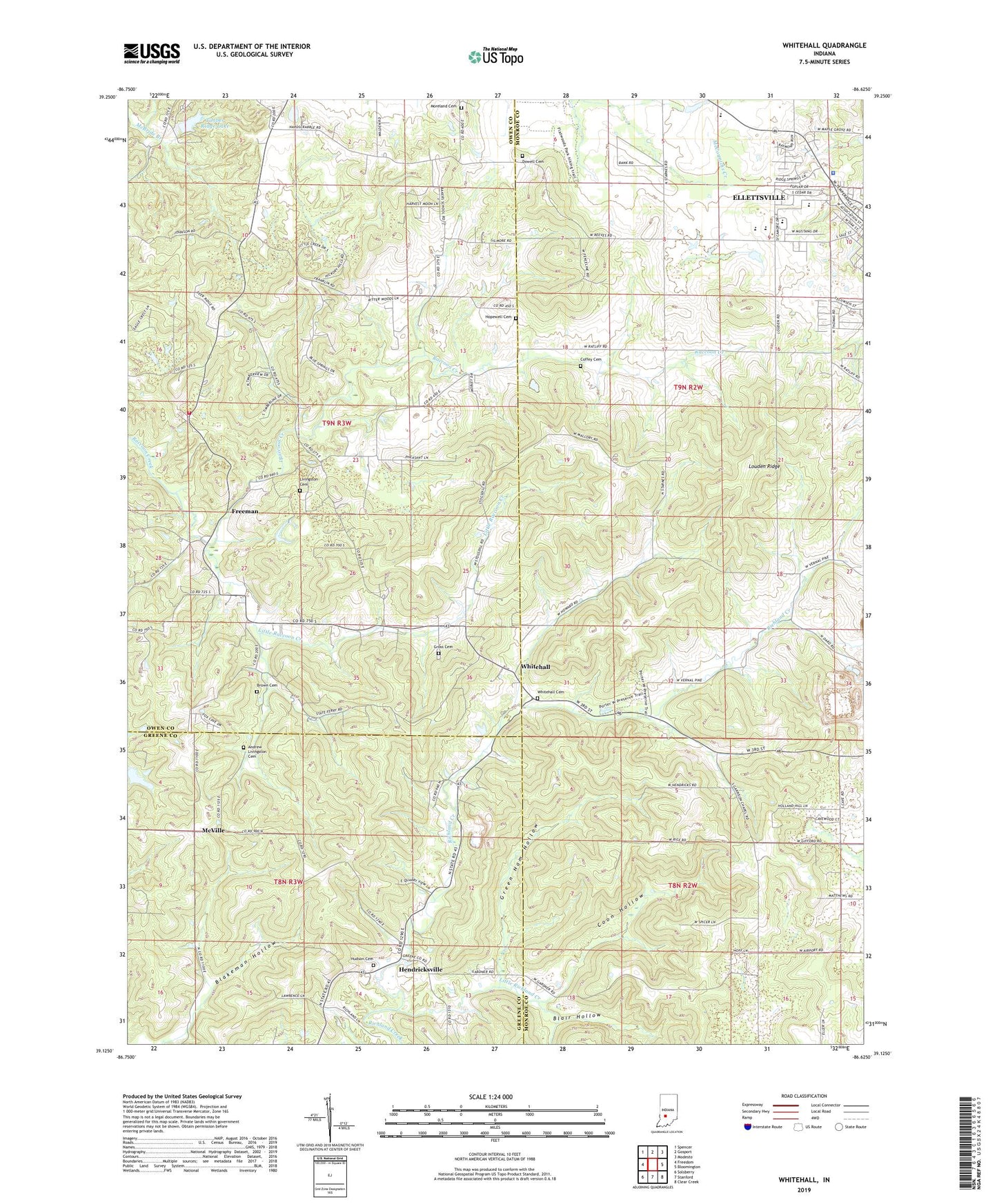
2022 topographic map quadrangle Whitehall in the state of Indiana. Scale: 1:24000. Based on the newly updated USGS 7.5' US Topo map series, this map is in the following counties: Monroe, Owen, Greene. The map contains contour data, water features, and other items you are used to seeing on USGS maps, but also has updated roads and other features. This is the next generation of topographic maps. Printed on high-quality waterproof paper with UV fade-resistant inks.
Quads adjacent to this one:
West: Freedom
Northwest: Spencer
North: Gosport
Northeast: Modesto
East: Bloomington
Southeast: Clear Creek
South: Stanford
Southwest: Solsberry
This map covers the same area as the classic USGS quad with code o39086b6.
Contains the following named places: Andrew Livingston Cemetery, Bethel Church, Blair Hollow, Blakeman Hollow, Boone Cave, Brown Cemetery, Clay Township - Owen County Fire Company, Coffey Cemetery, Coon Hollow, Dowell Cemetery, Ellettsville, Ellettsville Police Department, Freeman, Garrison Chapel, Green Ham Hollow, Gross Cemetery, Hendricksville, Hopewell Cemetery, Hudson Cemetery, Liberty Church, Little Flock Church, Little Raccoon Creek, Little Richland Creek, Livingston Cemetery, Louden Ridge, McVille, Moreland Cemetery, Mount Pleasant Church, Richland Church, Salem Church, Timber Ridge Lake, Timber Ridge Lake Dam, Township of Clay, Township of Richland, Whitehall, Whitehall Cemetery, WTTS-AM (Bloomington)