MyTopo
Freedom Indiana US Topo Map
Couldn't load pickup availability
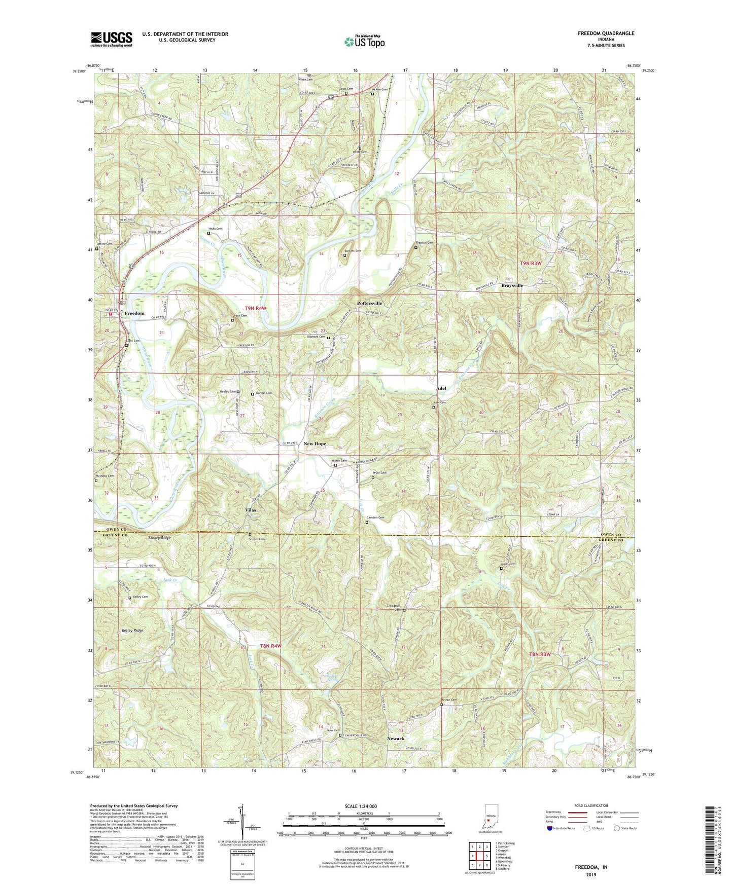
2022 topographic map quadrangle Freedom in the state of Indiana. Scale: 1:24000. Based on the newly updated USGS 7.5' US Topo map series, this map is in the following counties: Owen, Greene. The map contains contour data, water features, and other items you are used to seeing on USGS maps, but also has updated roads and other features. This is the next generation of topographic maps. Printed on high-quality waterproof paper with UV fade-resistant inks.
Quads adjacent to this one:
West: Arney
Northwest: Patricksburg
North: Spencer
Northeast: Gosport
East: Whitehall
Southeast: Stanford
South: Solsberry
Southwest: Bloomfield
This map covers the same area as the classic USGS quad with code o39086b7.
Contains the following named places: Adel, Adel Cemetery, Arthur Cemetery, Braysville, Burkett Cemetery, Burton Cemetery, Camden Cemetery, Defore Cemetery, Franklin Cemetery, Franklin Township Volunteer Fire Department Station 3, Freedom, Freedom Post Office, Goose Creek, Hedding Church, Hicks Cemetery, Kelley Cemetery, Kelley Ridge, Leach Cemetery, Lick Creek, Light Cemetery, Livingston Cemetery, McIndoo Cemetery, McKee Cemetery, Mills Creek, Minks Cemetery, Neeley Cemetery, New Hope, Newark, Oliphant Cemetery, Pottersville, Pryor Cemetery, Scott Cemetery, Snyder Cemetery, Stokey Ridge, Township of Franklin, Vilas, Waker Cemetery, Watkins Spring, White Cemetery