MyTopo
Williamsport Indiana US Topo Map
Couldn't load pickup availability
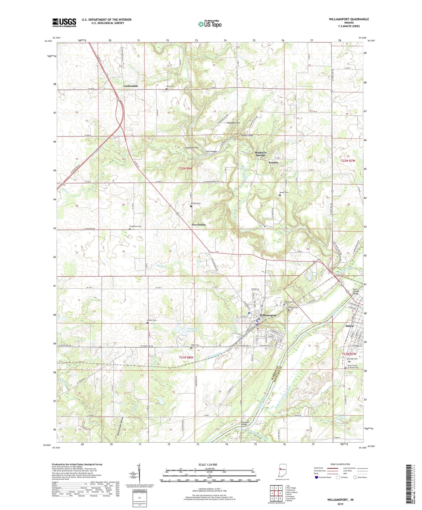
2022 topographic map quadrangle Williamsport in the state of Indiana. Scale: 1:24000. Based on the newly updated USGS 7.5' US Topo map series, this map is in the following counties: Warren, Fountain. The map contains contour data, water features, and other items you are used to seeing on USGS maps, but also has updated roads and other features. This is the next generation of topographic maps. Printed on high-quality waterproof paper with UV fade-resistant inks.
Quads adjacent to this one:
West: West Lebanon
Northwest: Tab
North: Pine Village
Northeast: Chatterton
East: Attica
Southeast: Mellott
South: Stone Bluff
Southwest: Covington
This map covers the same area as the classic USGS quad with code o40087c3.
Contains the following named places: Big Pine Creek, Big Shawnee Creek, Brier Cemetery, Carbondale, Copeland Hill, Desmond Able Lake, Desmond Able Lake Dam, Fall Branch, Fall Creek, Five Points, Fountain Ambulance, French Ditch, Goodwine Cemetery, Hickman Hights Church, Highland Cemetery, Hillside Cemetery, Hog Back Hill, Kester Cemetery, Kramer, Kramer Census Designated Place, Lovers Leap, McCabe Cemetery, Mudlavia Springs, Owens Cemetery, Paul Dresser Bridge, Riverside Cemetery, Robb Cemetery, Saint Francis of Xavier Cemetery, Saint Vincent Williamsport Hospital, Shawnee Bridge, Shawnee Lake, Town of Williamsport, Township of Liberty, Township of Washington, Twin Bridges, Warren County, Warren County Emergency Medical Services, Warren County Rescue Station 1, Warren County Sheriff's Office, Williamsport, Williamsport Elementary School, Williamsport Police Department, Williamsport Post Office, Williamsport Volunteer Fire Department Station 1, Williamsport Volunteer Fire Department Station 2