MyTopo
Mellott Indiana US Topo Map
Couldn't load pickup availability
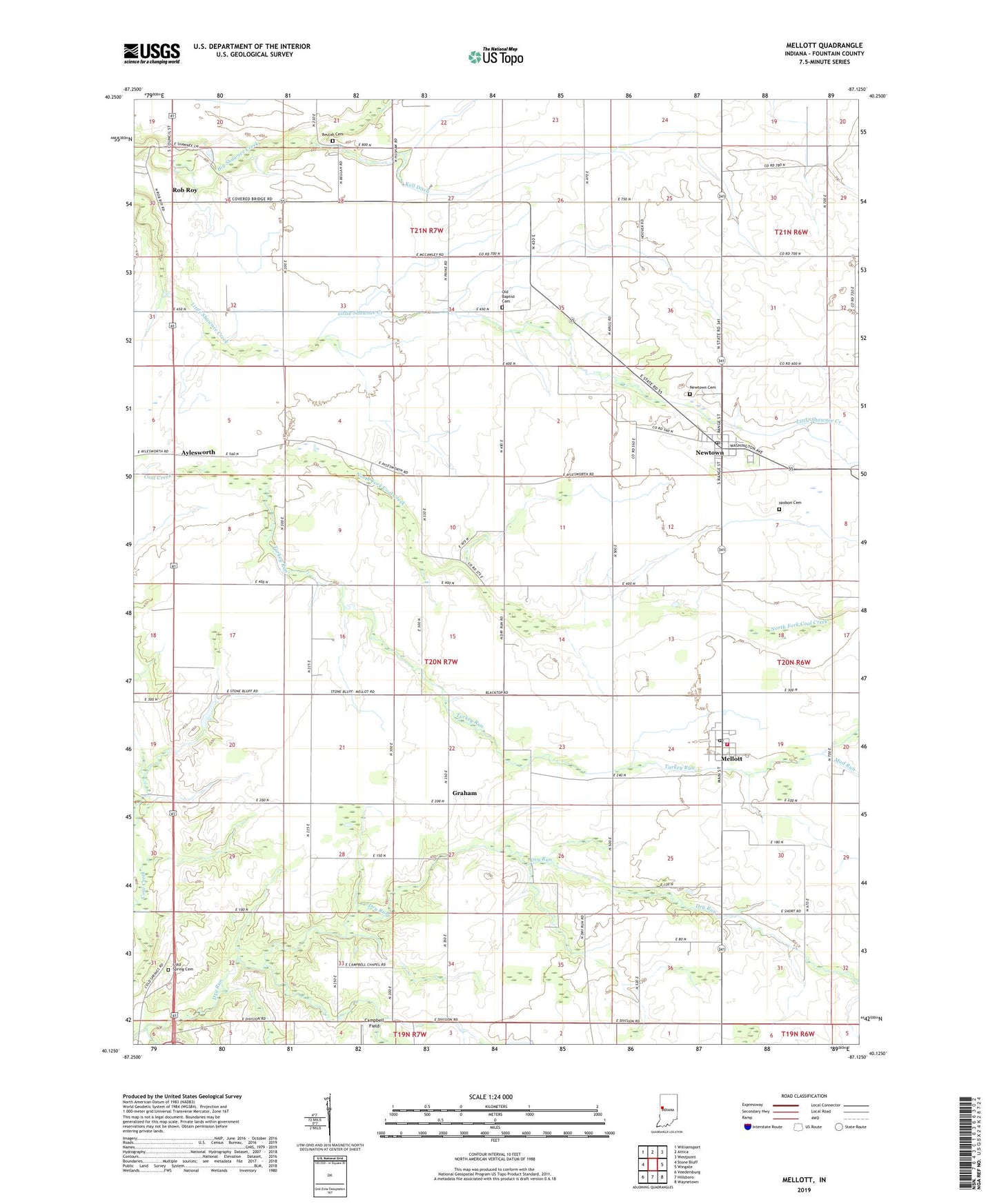
2022 topographic map quadrangle Mellott in the state of Indiana. Scale: 1:24000. Based on the newly updated USGS 7.5' US Topo map series, this map is in the following counties: Fountain. The map contains contour data, water features, and other items you are used to seeing on USGS maps, but also has updated roads and other features. This is the next generation of topographic maps. Printed on high-quality waterproof paper with UV fade-resistant inks.
Quads adjacent to this one:
West: Stone Bluff
Northwest: Williamsport
North: Attica
Northeast: Westpoint
East: Wingate
Southeast: Waynetown
South: Hillsboro
Southwest: Veedersburg
This map covers the same area as the classic USGS quad with code o40087b2.
Contains the following named places: Aylesworth, Beulah Cemetery, Campbell Chapel, Campbell Field, Cold Spring Cemetery, Graham, Harrison Lake, Hodson Cemetery, Hunter Corner, Kell Ditch, Mellott, Mellott Post Office, Mellott Volunteer Fire Department, Mud Run, Newtown, Newtown Cemetery, Newtown Post Office, North Fork Coal Creek, Old Baptist Cemetery, Rob Roy, Simpson Corner, Stephens Crossing, Town of Mellott, Town of Newtown, Township of Richland, Turkey Run, Union Church, ZIP Codes: 47958, 47969, 47987