MyTopo
Windfall Indiana US Topo Map
Couldn't load pickup availability
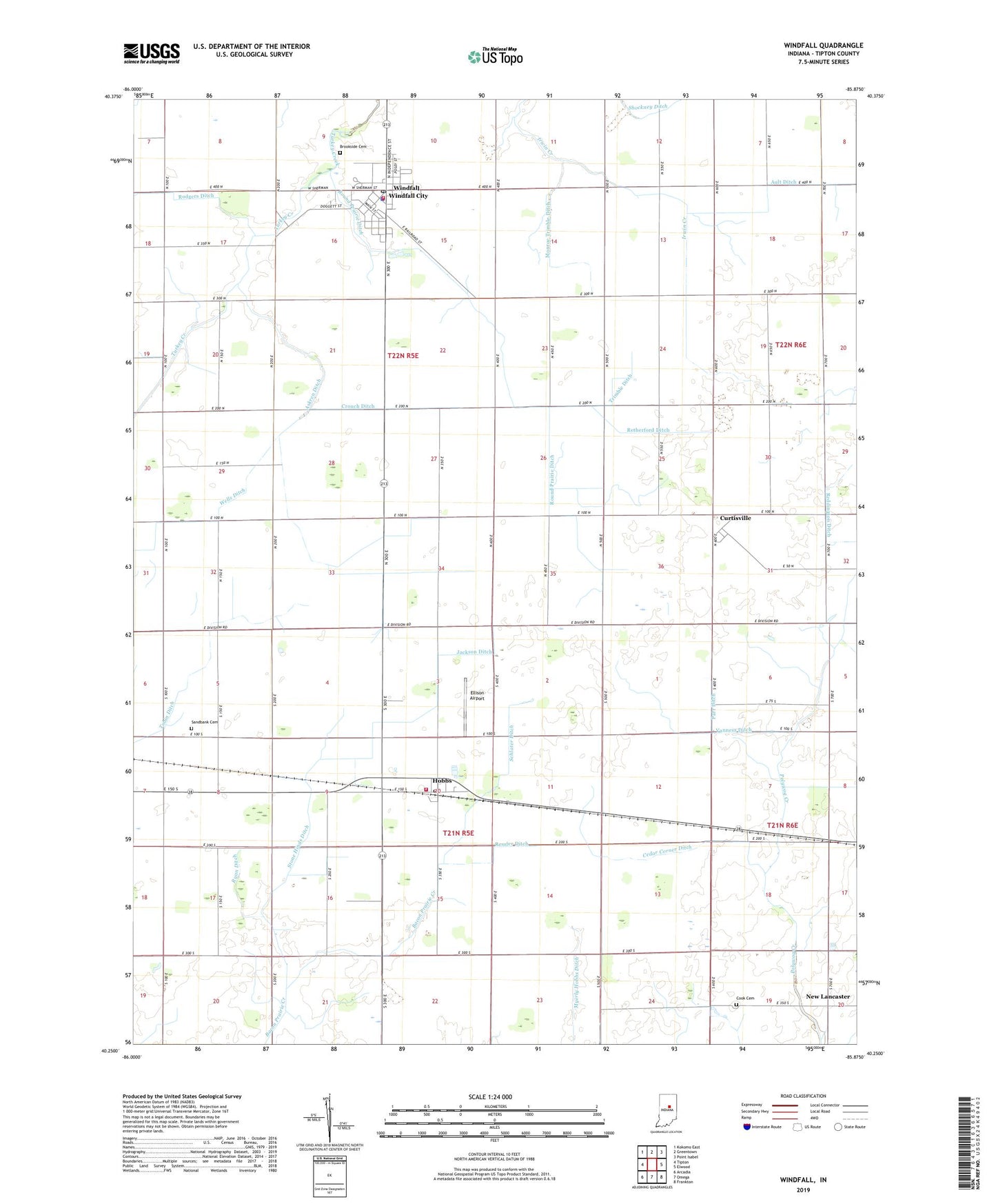
2022 topographic map quadrangle Windfall in the state of Indiana. Scale: 1:24000. Based on the newly updated USGS 7.5' US Topo map series, this map is in the following counties: Tipton. The map contains contour data, water features, and other items you are used to seeing on USGS maps, but also has updated roads and other features. This is the next generation of topographic maps. Printed on high-quality waterproof paper with UV fade-resistant inks.
Quads adjacent to this one:
West: Tipton
Northwest: Kokomo East
North: Greentown
Northeast: Point Isabel
East: Elwood
Southeast: Frankton
South: Omega
Southwest: Arcadia
This map covers the same area as the classic USGS quad with code o40085c8.
Contains the following named places: Askren Ditch, Ault Ditch, Brookside Cemetery, Cedar Corner Ditch, Charles Ditch, Cook Cemetery, Crouch Ditch, Curtisville, Ellison Airport, Hazeldell Church, Hobbs, Hobbs Post Office, Jackson Ditch, Madison Township Volunteer Fire Department, Monroe Trimble Ditch, Myerly Ditch, New Lancaster, Parr Ditch, Reddington Ditch, Ressler Ditch, Retherford Ditch, Rodgers Ditch, Round Prairie Ditch, Ryan Ditch, Sandbank Cemetery, Schlater Ditch, Stone Hinds Ditch, Tobin Ditch, Town of Windfall City, Township of Madison, Township of Wildcat, Trimble Ditch, Vanness Ditch, Wells Ditch, Wildcat Township Volunteer Fire Department, Windfall, Windfall Elementary School, Windfall Police Department, Windfall Post Office, Zea Mays Airport, Zittinger Ditch, ZIP Codes: 46047, 46076