MyTopo
Point Isabel Indiana US Topo Map
Couldn't load pickup availability
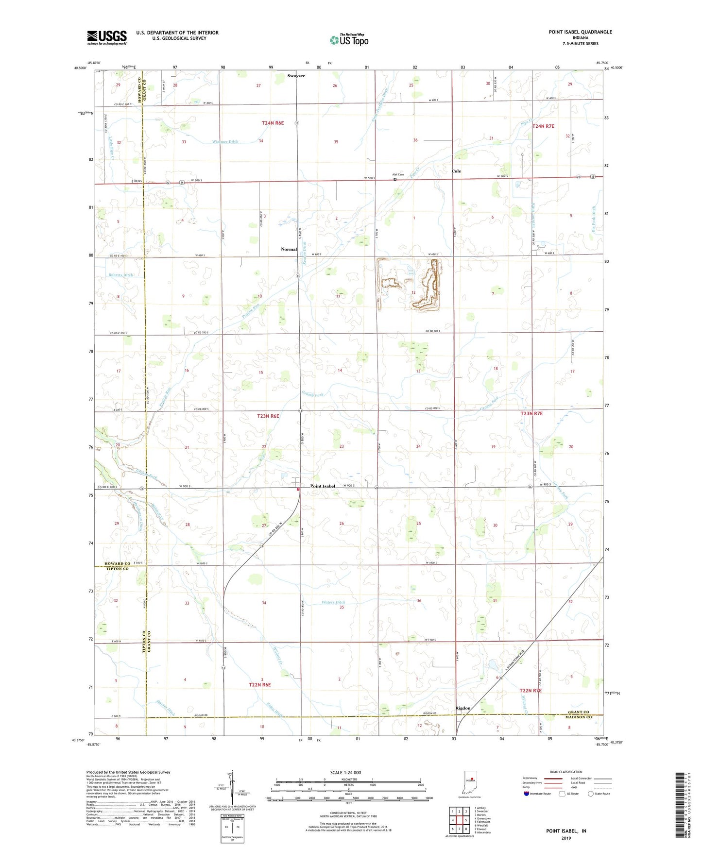
2022 topographic map quadrangle Point Isabel in the state of Indiana. Scale: 1:24000. Based on the newly updated USGS 7.5' US Topo map series, this map is in the following counties: Grant, Howard, Madison, Tipton. The map contains contour data, water features, and other items you are used to seeing on USGS maps, but also has updated roads and other features. This is the next generation of topographic maps. Printed on high-quality waterproof paper with UV fade-resistant inks.
Quads adjacent to this one:
West: Greentown
Northwest: Amboy
North: Sweetser
Northeast: Marion
East: Fairmount
Southeast: Alexandria
South: Elwood
Southwest: Windfall
This map covers the same area as the classic USGS quad with code o40085d7.
Contains the following named places: Alel Cemetery, Antioch Church, Clear Water Park, Cole, Dupouy Airport, Green Township Volunteer Fire Department, Hanes Ditch, Hutcherson Ditch, Jones Chapel, Keaton Ditch, Knox Chapel, Maple Run Church, Normal, Pattison Ditch, Point Isabel, Point Isabel Census Designated Place, Poley Walk, Prairie Run, Rigdon, Roberts Ditch, Sims, Township of Green, Waters Ditch, Wimmer Ditch, ZIP Code: 46986