MyTopo
Greentown Indiana US Topo Map
Couldn't load pickup availability
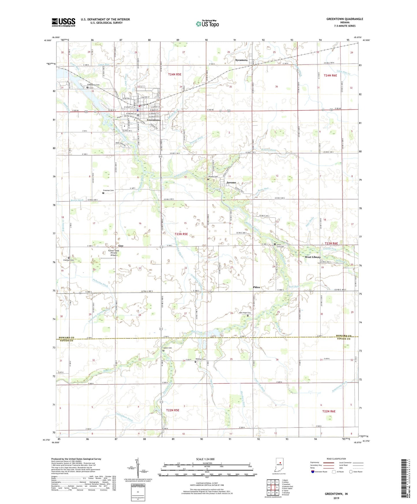
2022 topographic map quadrangle Greentown in the state of Indiana. Scale: 1:24000. Based on the newly updated USGS 7.5' US Topo map series, this map is in the following counties: Howard, Tipton. The map contains contour data, water features, and other items you are used to seeing on USGS maps, but also has updated roads and other features. This is the next generation of topographic maps. Printed on high-quality waterproof paper with UV fade-resistant inks.
Quads adjacent to this one:
West: Kokomo East
Northwest: Miami
North: Amboy
Northeast: Sweetser
East: Point Isabel
Southeast: Elwood
South: Windfall
Southwest: Tipton
This map covers the same area as the classic USGS quad with code o40085d8.
Contains the following named places: Armstrong Ditch, Barrett Ditch, Beard Ditch, Brunk Ditch, Center Grove Church, Chandler Cemetery, Conway Ditch, Cottingham Ditch, Duncan Ditch, Eastern Junior and Senior High School, First Salem Church, Fowler Field /Private Airport, Freeman Cemetery, Freeman Ditch, Gifford Ditch, Grassy Fork, Green Run, Greenlawn Cemetery, Greentown, Greentown Police Department, Greentown Post Office, Greentown Volunteer Fire Company, Guy, Hall Airport, Hardin Ditch, Hook Run, Howard Chapel, Howard County Airport, Irwin Creek, Jerome, Jerome Cemetery, Lawn Run, Legg Ditch, Loop Drain, Middle Fork, Middle Fork Ditch, Middle Fork Wildcat Creek, Moon Barcley Ditch, Mount Zion Church, Mud Creek, New Hope Cemetery, New Salem Church, Overman Ditch, Peck Run, Phlox, Pickering Ditch, Pint Run, Riggs Ditch, Roberts Ditch, Rome Run, Salem Cemetery, Shockney Ditch, Sims Drain, Smith Ditch, Sycamore, Town of Greentown, Township of Union, Tributary Number One, Tributary Number Two, Turkey Creek, Union Civil Cemetery, West Liberty, Wheeler Cemetery, Windfall Sand and Gravel Pit, ZIP Code: 46936