MyTopo
Elwood Indiana US Topo Map
Couldn't load pickup availability
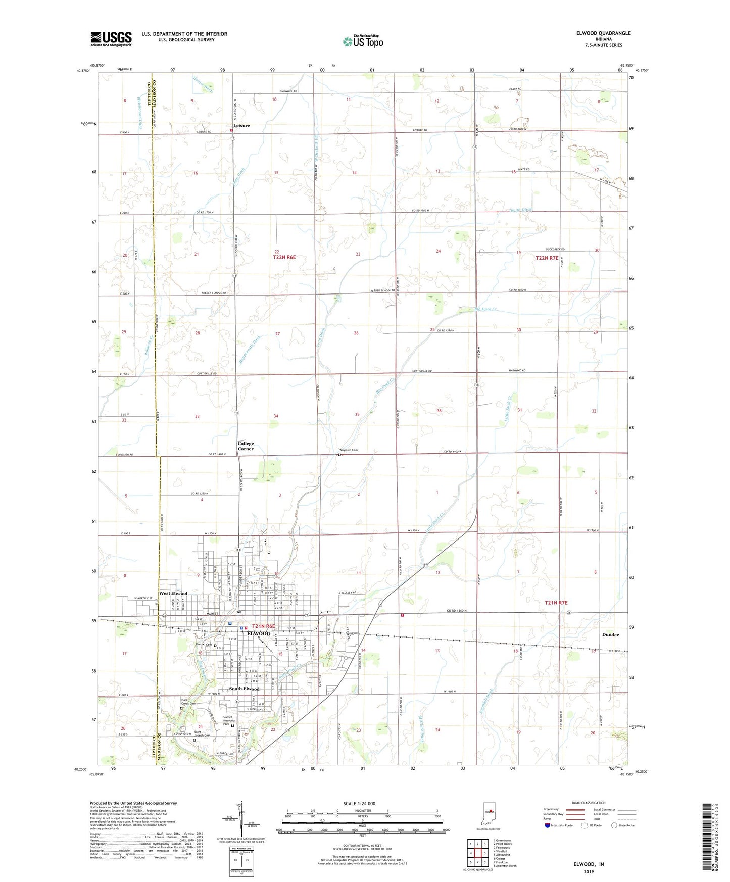
2022 topographic map quadrangle Elwood in the state of Indiana. Scale: 1:24000. Based on the newly updated USGS 7.5' US Topo map series, this map is in the following counties: Madison, Tipton. The map contains contour data, water features, and other items you are used to seeing on USGS maps, but also has updated roads and other features. This is the next generation of topographic maps. Printed on high-quality waterproof paper with UV fade-resistant inks.
Quads adjacent to this one:
West: Windfall
Northwest: Greentown
North: Point Isabel
Northeast: Fairmount
East: Alexandria
Southeast: Anderson North
South: Frankton
Southwest: Omega
This map covers the same area as the classic USGS quad with code o40085c7.
Contains the following named places: Callaway Park, City of Elwood, College Corner, Duck Creek Cemetery, Duck Creek Volunteer Fire Department, Dundee, Edgewood Elementary School, Elwood, Elwood Airport, Elwood Cemetery, Elwood Country Club, Elwood Fire Department, Elwood Junior High School, Elwood Police Department, Elwood Post Office, Haines Ditch, Hoppenrath Ditch, Leisure, Lynwood School, McCluret Ditch, Oakland Elementary School, Pipe Creek Township Volunteer Fire Department, Red Corner School, Saint Joseph Cemetery, Saint Stephans Church, Saint Vincent Mercy Hospital, Shay Ditch, Shiloh Church, Smith Ditch, South Elwood, Sunset Memorial Park, Swanfelt Ditch, Todd Ditch, Township of Duck Creek, Union Valley Church, Washington Elementary School, Waymire Cemetery, WBMP-FM (Elwood), West Drake Ditch, West Elwood, ZIP Code: 46036