MyTopo
Oliver Lake Indiana US Topo Map
Couldn't load pickup availability
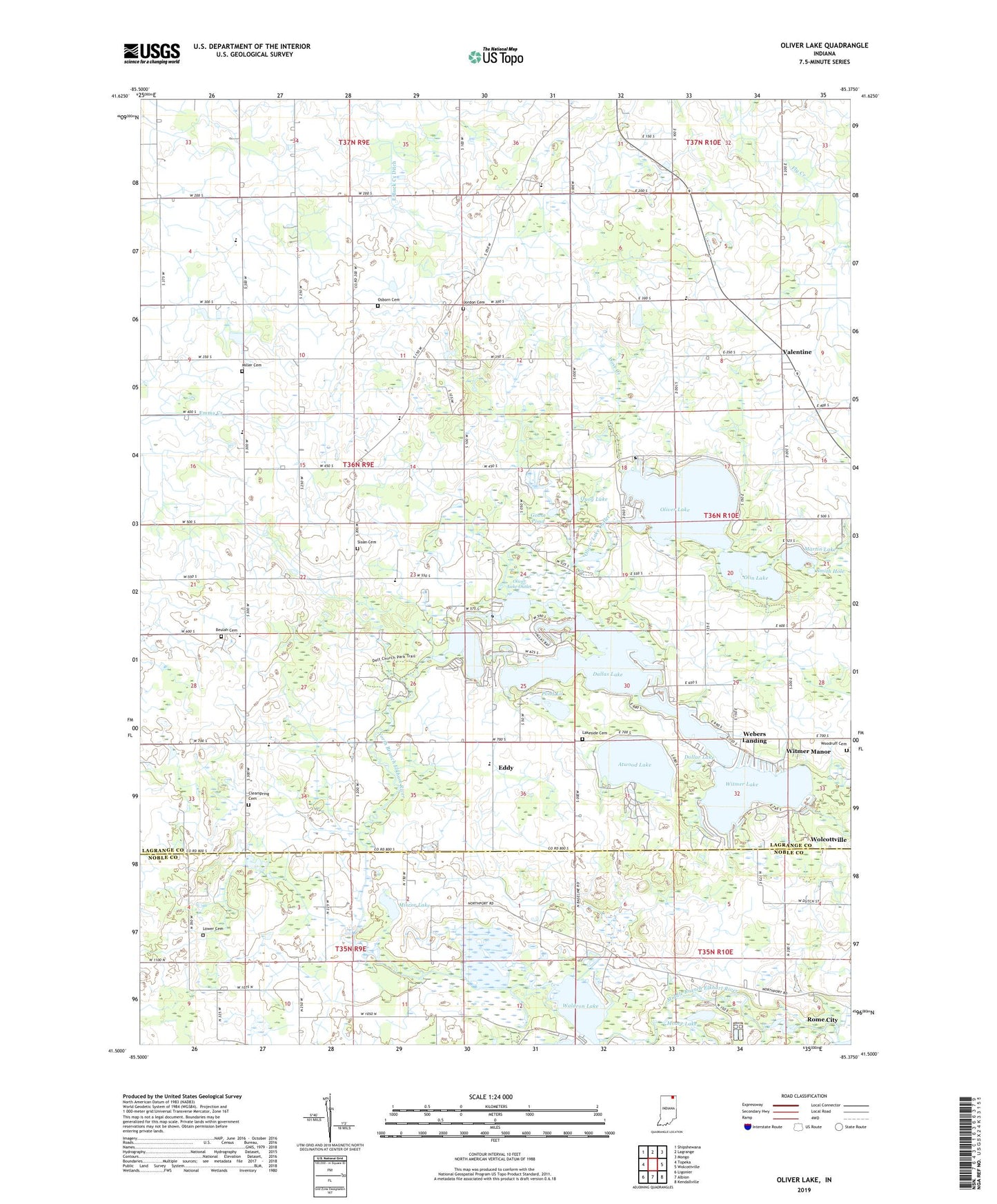
2022 topographic map quadrangle Oliver Lake in the state of Indiana. Scale: 1:24000. Based on the newly updated USGS 7.5' US Topo map series, this map is in the following counties: LaGrange, Noble. The map contains contour data, water features, and other items you are used to seeing on USGS maps, but also has updated roads and other features. This is the next generation of topographic maps. Printed on high-quality waterproof paper with UV fade-resistant inks.
Quads adjacent to this one:
West: Topeka
Northwest: Shipshewana
North: Lagrange
Northeast: Mongo
East: Wolcottville
Southeast: Kendallville
South: Albion
Southwest: Ligonier
This map covers the same area as the classic USGS quad with code o41085e4.
Contains the following named places: A.R.C.A. Conference Center-Catholic Retreat, Atwood Lake, Basin Lake, Bass Hole, Beulah Cemetery, Beulah Church, Clearspring Cemetery, Dallas Lake, Dollar Lake, Dove Creek, Eddy, Eddy Village School, Goose Pond, Green Chapel, Hackenburg Lake, Hawpatch School, Holsinger Hole, Indian Lake, Indian Lakes, Jones Lake, Jordon Cemetery, Lake View Church, Lakeside Cemetery, Limberlost Camp, Little Elkhart Creek, Lower Cemetery, Martin Lake, Meadow Lane School, Messick Lake, Middle Branch Elkhart River, Miller Cemetery, Mirror Lake, Moore Lake, New Valentine School, Olin Lake, Oliver Lake, Oliver Lake Airport, Oliver Lake Outlet, Osborn Cemetery, Pond Lil, Quog Lake, Sand Hill School, Sloan Cemetery, Smith Hole, Spring Hill School, Spring Lake, Taylor School, The Spreads, Township of Clearspring, Valentine, Valentine United Methodist Church, Webers Landing, Westler Lake, Witmer Lake, Witmer Manor, Woodruff Cemetery, Zion United Baptist Church, ZIP Code: 46784