MyTopo
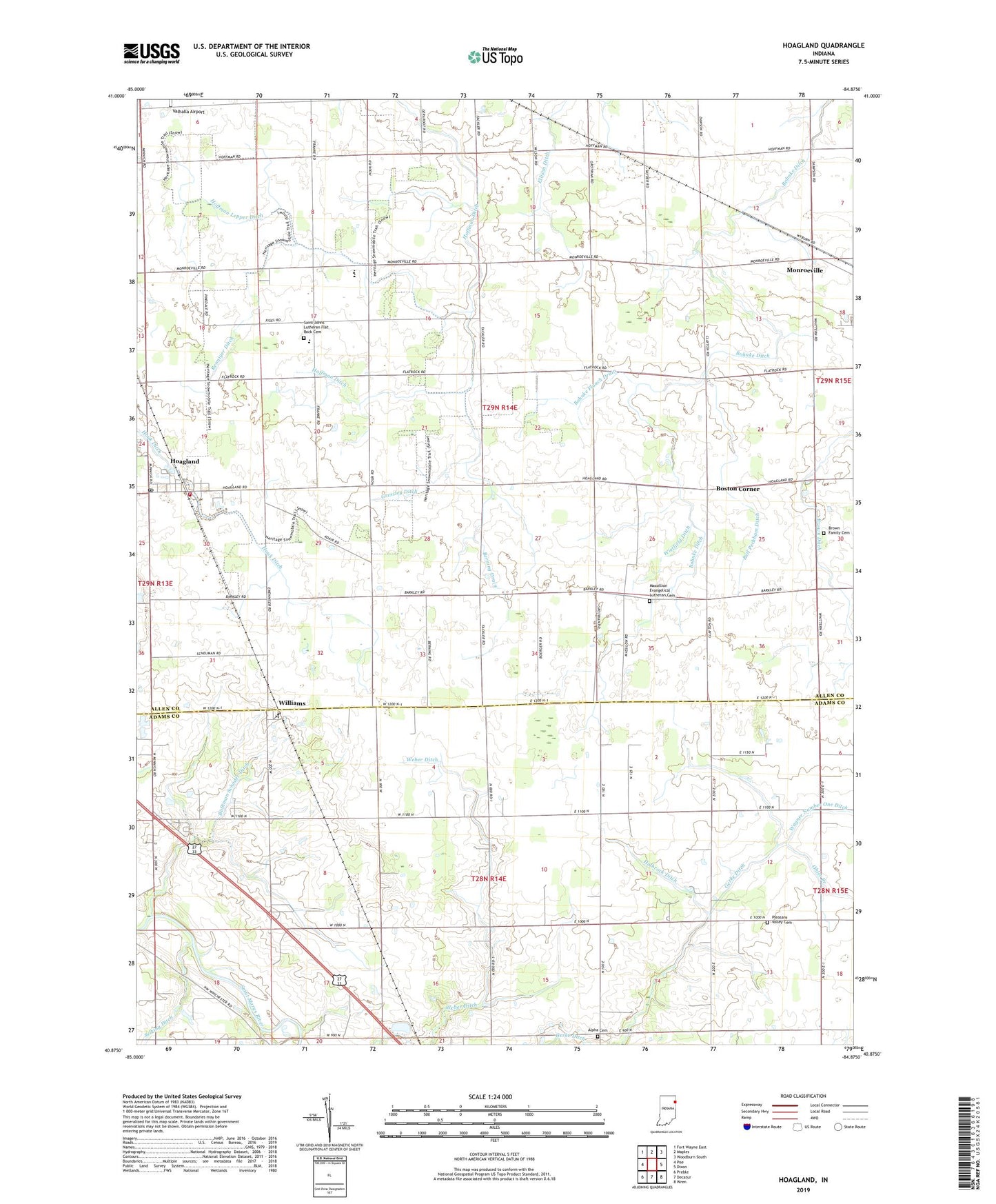
Hoagland Indiana US Topo Map
Couldn't load pickup availability
2022 topographic map quadrangle Hoagland in the state of Indiana. Scale: 1:24000. Based on the newly updated USGS 7.5' US Topo map series, this map is in the following counties: Allen, Adams. The map contains contour data, water features, and other items you are used to seeing on USGS maps, but also has updated roads and other features. This is the next generation of topographic maps. Printed on high-quality waterproof paper with UV fade-resistant inks.
Quads adjacent to this one:
West: Poe
Northwest: Fort Wayne East
North: Maples
Northeast: Woodburn South
East: Dixon
Southeast: Wren
South: Decatur
Southwest: Preble
This map covers the same area as the classic USGS quad with code o40084h8.
Contains the following named places: Adams County Sand and Gravel Pit, Alpha Cemetery, Bell Peckham Ditch, Berning Drain, Bobilya Park, Bohnke Ditch, Bohnke Flauch Drain, Boston Corner, Brown Ditch, Brown Family Cemetery, Bulhman Schoder Ditch, Consolidated School, Gerke Ditch, Gressley Ditch, Hoagland, Hoagland Census Designated Place, Hoagland Fire Department and Emergency Medical Services, Hoagland Post Office, Hoffman Ditch, Hoffman Lepper Ditch, Holbrock Ditch, Marquardt Church, Massillion Evangelical Lutheran Cemetery, Ohler Branch, Pleasant Valley Cemetery, Renniger Ditch, Saint Johns Lutheran Flat Rock Cemetery, Saint Johns School, Saint Peter-Immanuel Lutheran School, Selking Ditch, Township of Madison, Township of Root, Valhalla Airport, Wagner Number One Ditch, Weber Ditch, Wietfield Ditch, Williams, ZIP Code: 46773