MyTopo
Abingdon Iowa US Topo Map
Couldn't load pickup availability
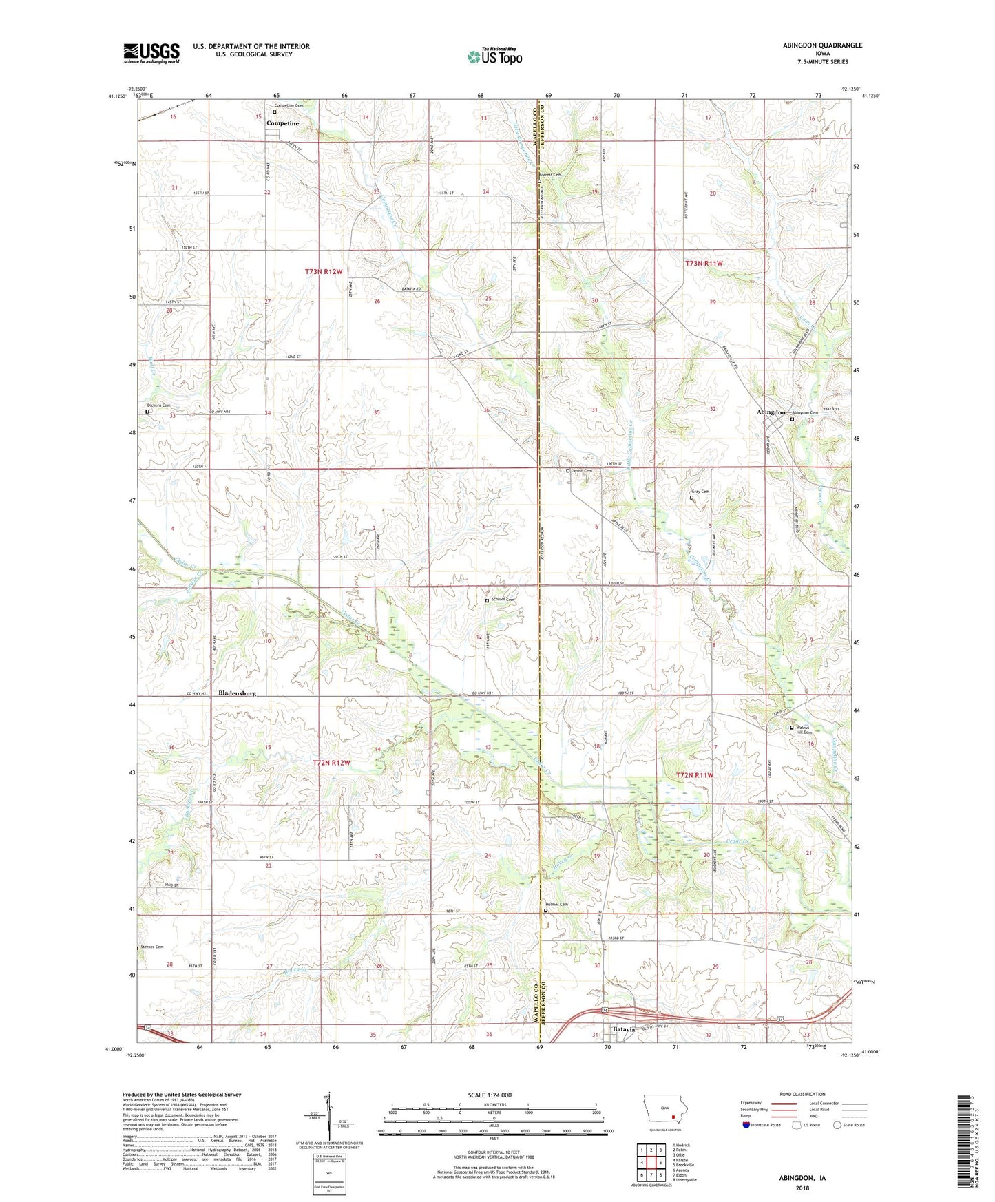
2022 topographic map quadrangle Abingdon in the state of Iowa. Scale: 1:24000. Based on the newly updated USGS 7.5' US Topo map series, this map is in the following counties: Wapello, Jefferson. The map contains contour data, water features, and other items you are used to seeing on USGS maps, but also has updated roads and other features. This is the next generation of topographic maps. Printed on high-quality waterproof paper with UV fade-resistant inks.
Quads adjacent to this one:
West: Farson
Northwest: Hedrick
North: Pekin
Northeast: Ollie
East: Brookville
Southeast: Libertyville
South: Eldon
Southwest: Agency
This map covers the same area as the classic USGS quad with code o41092a2.
Contains the following named places: Abingdon, Abingdon Cemetery, Abingdon Post Office, Batavia Peoples Church, Bladensburg, Bladensburg Christian Church, Bladensburg Post Office, Buckeye Creek, Competine, Competine Cemetery, Competine Post Office, Coon Creek, Dickens Cemetery, Forrest Cemetery, Gobble Park, Gray Cemetery, Holmes Cemetery, Honey Creek, Johnson/Noel Buckeye Area, Jordan Creek, Little Competine Creek, Schrom Cemetery, Smith Cemetery, Township of Competine, Township of Pleasant, Walnut Hill Cemetery, Yampa, Yampa Post Office, ZIP Code: 52533