MyTopo
Farson Iowa US Topo Map
Couldn't load pickup availability
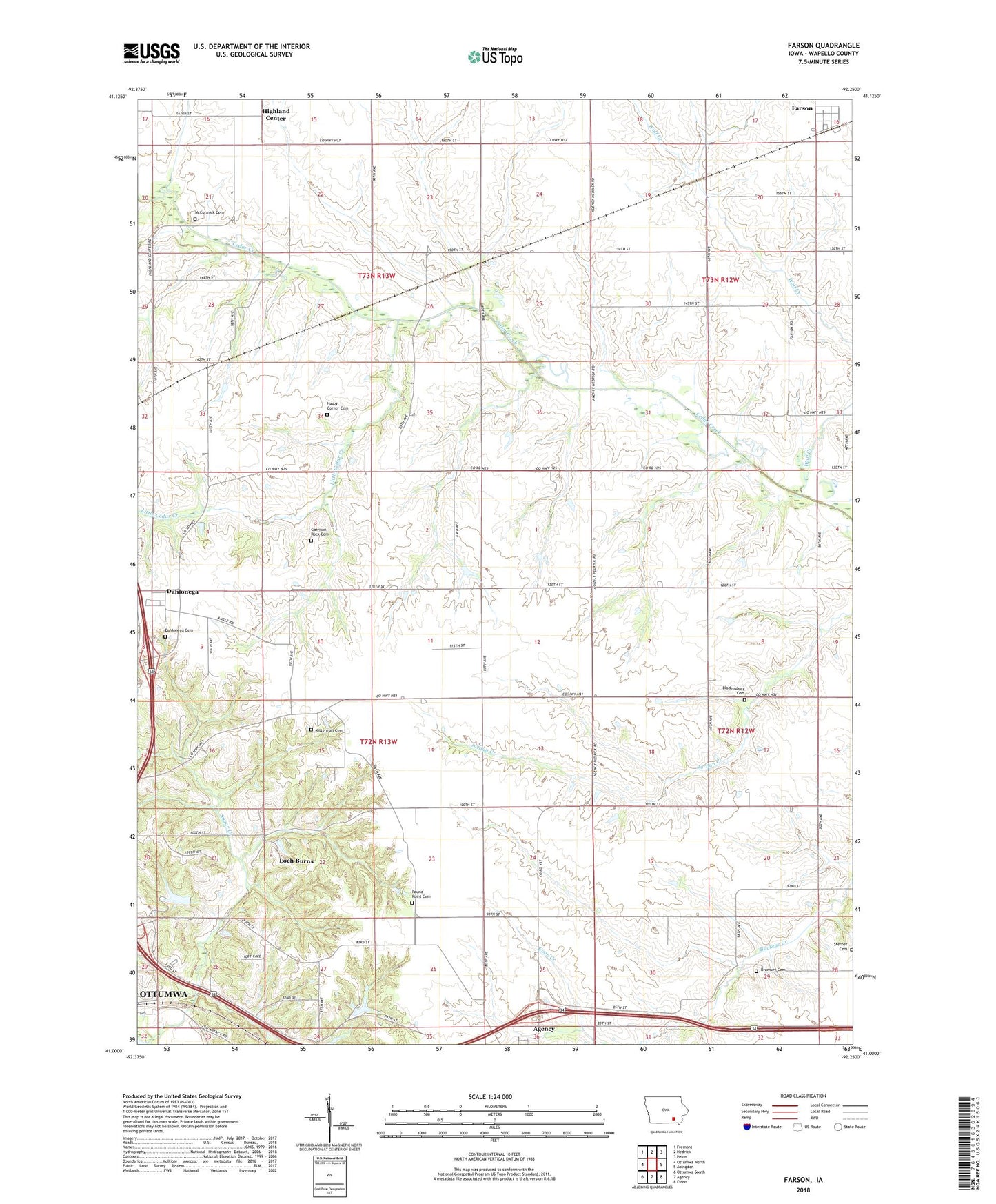
2022 topographic map quadrangle Farson in the state of Iowa. Scale: 1:24000. Based on the newly updated USGS 7.5' US Topo map series, this map is in the following counties: Wapello. The map contains contour data, water features, and other items you are used to seeing on USGS maps, but also has updated roads and other features. This is the next generation of topographic maps. Printed on high-quality waterproof paper with UV fade-resistant inks.
Quads adjacent to this one:
West: Ottumwa North
Northwest: Fremont
North: Hedrick
Northeast: Pekin
East: Abingdon
Southeast: Eldon
South: Agency
Southwest: Ottumwa South
This map covers the same area as the classic USGS quad with code o41092a3.
Contains the following named places: Bladensburg Cemetery, Brumsey Cemetery, Coon Creek, Crossroads School, Dahlonega, Dahlonega Cemetery, Dahlonega Post Office, Farson, Farson Post Office, Garrison Rock Cemetery, Highland School, Jonathan Woody Historical Marker, Kitterman Cemetery, Little Cedar Creek, Loch Burns, McCormick Cemetery, Nasby Corner Cemetery, Nasby School, Pleasant Grove School, Round Point Cemetery, Round Point School, Sterner Cemetery, Sugar Creek, Township of Dahlonega, Township of Highland, Tunis Post Office, Wapello County Grain Incorporated Elevator, Wolf Creek