MyTopo
Armstrong SE Iowa US Topo Map
Couldn't load pickup availability
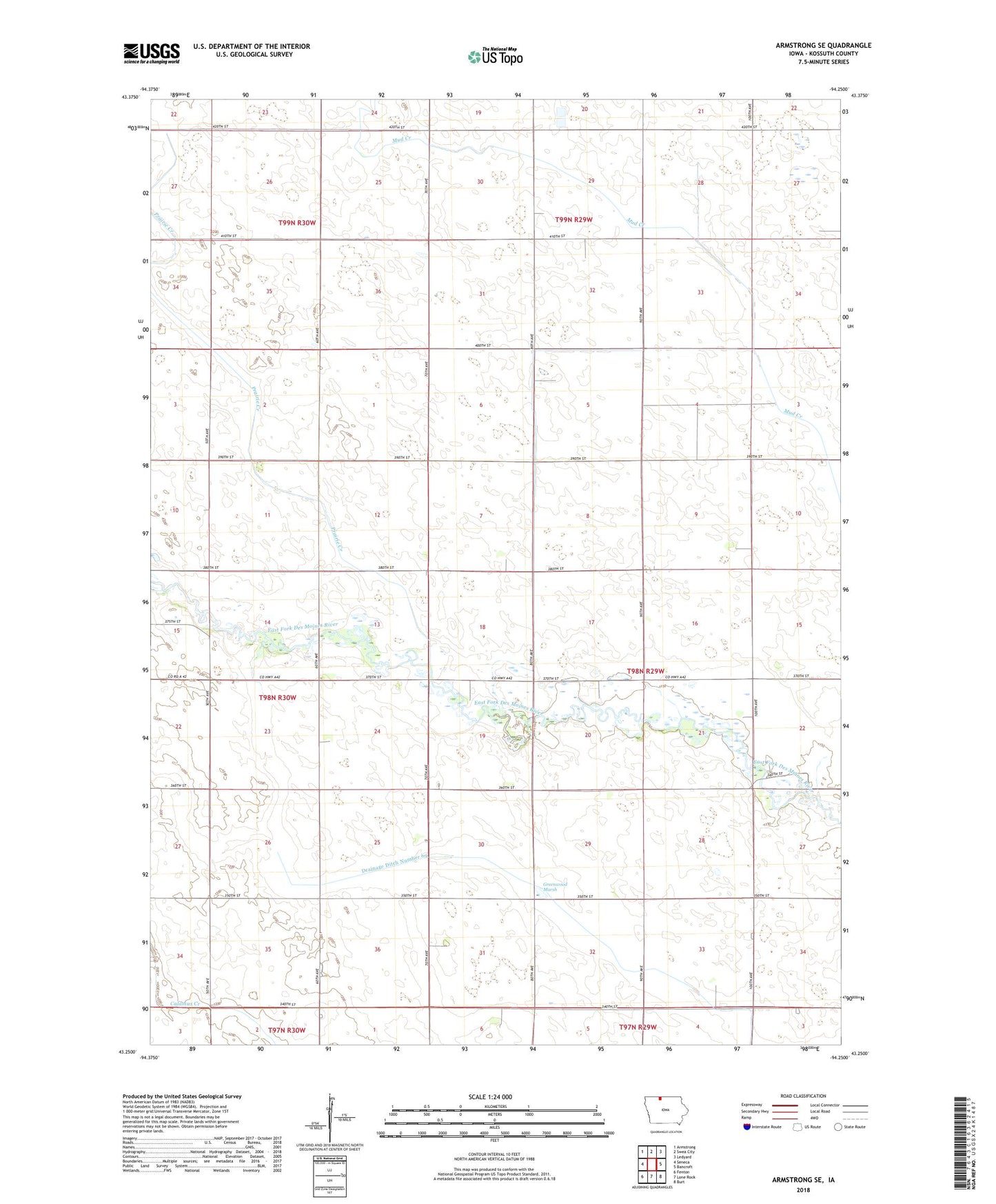
2022 topographic map quadrangle Armstrong SE in the state of Iowa. Scale: 1:24000. Based on the newly updated USGS 7.5' US Topo map series, this map is in the following counties: Kossuth. The map contains contour data, water features, and other items you are used to seeing on USGS maps, but also has updated roads and other features. This is the next generation of topographic maps. Printed on high-quality waterproof paper with UV fade-resistant inks.
Quads adjacent to this one:
West: Seneca
Northwest: Armstrong
North: Swea City
Northeast: Ledyard
East: Bancroft
Southeast: Burt
South: Lone Rock
Southwest: Fenton
This map covers the same area as the classic USGS quad with code o43094c3.
Contains the following named places: Buaer Landing Strip, Greenwood Marsh, Prairie Creek, Township of Greenwood