MyTopo
Swea City Iowa US Topo Map
Couldn't load pickup availability
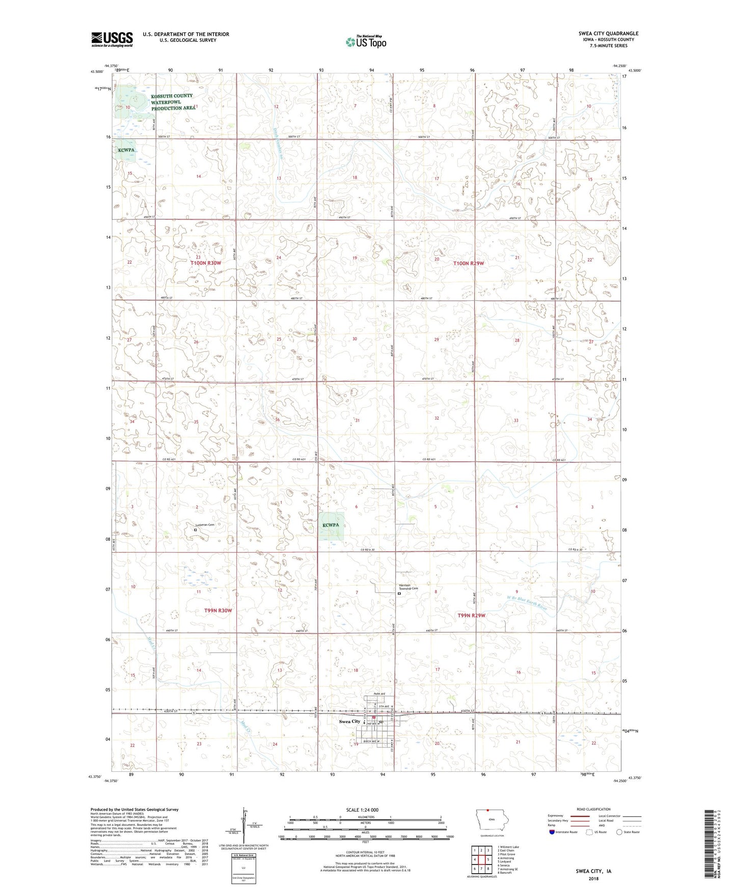
2022 topographic map quadrangle Swea City in the state of Iowa. Scale: 1:24000. Based on the newly updated USGS 7.5' US Topo map series, this map is in the following counties: Kossuth. The map contains contour data, water features, and other items you are used to seeing on USGS maps, but also has updated roads and other features. This is the next generation of topographic maps. Printed on high-quality waterproof paper with UV fade-resistant inks.
Quads adjacent to this one:
West: Armstrong
Northwest: Willmert Lake
North: East Chain
Northeast: Pilot Grove
East: Ledyard
Southeast: Bancroft
South: Armstrong SE
Southwest: Seneca
This map covers the same area as the classic USGS quad with code o43094d3.
Contains the following named places: Bancroft Lake, City of Swea City, Ditch Number 60, Drainage Ditch Number 3, Farmers Co-op Elevator, First Baptist Church, Harrison Township Cemetery, Immanuel Lutheran Church, Lutheran Cemetery, North Kossuth Elementary and North Union Middle School, North Kossuth Medical Clinic, North Sentral Kossuth High School, Open Bible Church, Our Saviour Lutheran Church, Rock N Sons Feedlot, State Line Marsh State Game Management Area, Swea City, Swea City Ambulance, Swea City City Hall, Swea City Police Department, Swea City Post Office, Swea City Public Library, Swea City Volunteer Fire Department, Swea Post Office, Township of Grant, Township of Harrison, United Methodist Church, ZIP Code: 50590