MyTopo
Baxter SE Iowa US Topo Map
Couldn't load pickup availability
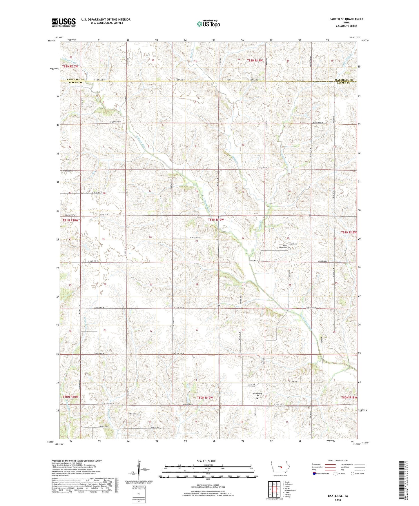
2022 topographic map quadrangle Baxter SE in the state of Iowa. Scale: 1:24000. Based on the newly updated USGS 7.5' US Topo map series, this map is in the following counties: Jasper, Marshall. The map contains contour data, water features, and other items you are used to seeing on USGS maps, but also has updated roads and other features. This is the next generation of topographic maps. Printed on high-quality waterproof paper with UV fade-resistant inks.
Quads adjacent to this one:
West: Baxter
Northwest: Rhodes
North: Melbourne
Northeast: Laurel
East: Alloway Creek
Southeast: Kellogg
South: Newton
Southwest: Colfax
This map covers the same area as the classic USGS quad with code o41093g1.
Contains the following named places: Church of Christ Number 1, Horn, Horn Post Office, Linder Cemetery, Little Snipe Creek, Saint Johns Cemetery, Snipe Creek, Township of Malaka, Wittemberg Cemetery, Wittemberg Church, Wittemberg Grange Hall, Zoar Cemetery