MyTopo
Rhodes Iowa US Topo Map
Couldn't load pickup availability
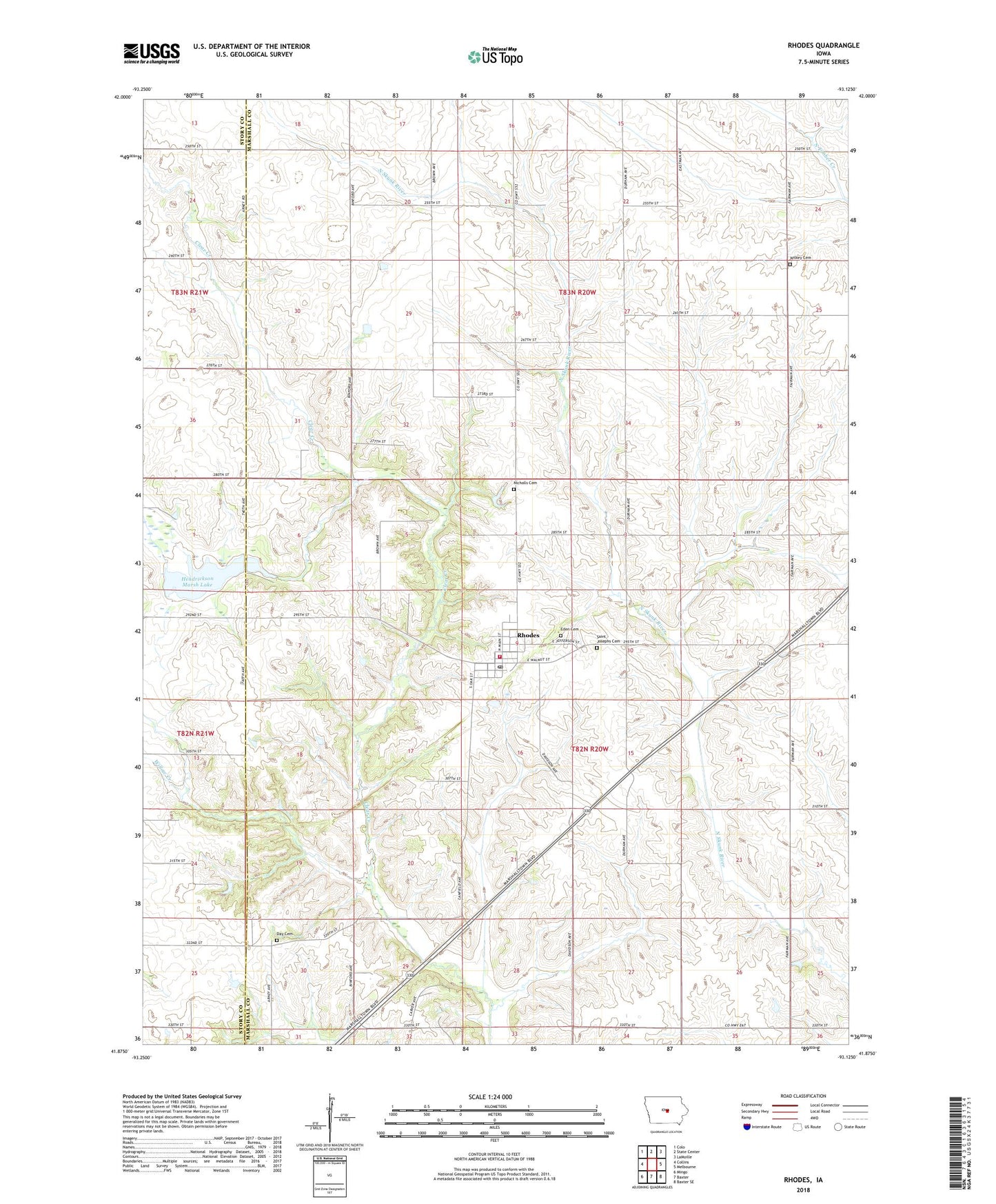
2022 topographic map quadrangle Rhodes in the state of Iowa. Scale: 1:24000. Based on the newly updated USGS 7.5' US Topo map series, this map is in the following counties: Marshall, Story. The map contains contour data, water features, and other items you are used to seeing on USGS maps, but also has updated roads and other features. This is the next generation of topographic maps. Printed on high-quality waterproof paper with UV fade-resistant inks.
Quads adjacent to this one:
West: Collins
Northwest: Colo
North: State Center
Northeast: LaMoille
East: Melbourne
Southeast: Baxter SE
South: Baxter
Southwest: Mingo
This map covers the same area as the classic USGS quad with code o41093h2.
Contains the following named places: City of Rhodes, Day Cemetery, Eden Cemetery, Edenville, German Baptist Cemetery, Hendrickson Marsh Dam, Hendrickson Marsh Lake, Hendrickson Marsh State Hunting Area, Nicholls Cemetery, Rhodes, Rhodes Fire Department and Emergency Medical Services, Rhodes First Responders, Rhodes Post Office, Saint Josephs Cemetery, Township of Eden, Township of State Center, Willow Creek, ZIP Code: 50234