MyTopo
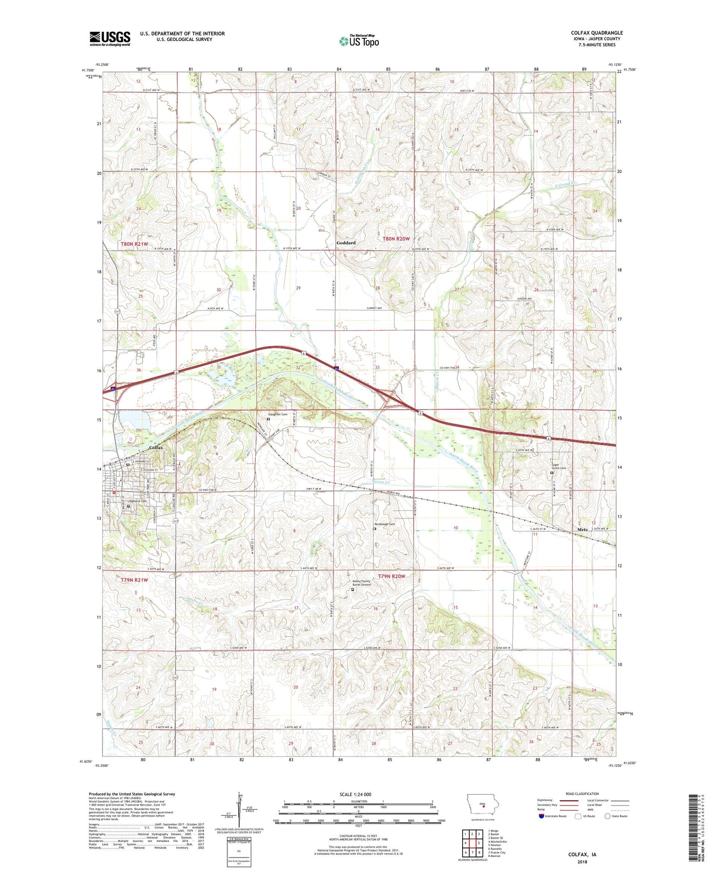
Colfax Iowa US Topo Map
Couldn't load pickup availability
2023 topographic map quadrangle Colfax in the state of Iowa. Scale: 1:24000. Based on the newly updated USGS 7.5' US Topo map series, this map is in the following counties: Jasper. The map contains contour data, water features, and other items you are used to seeing on USGS maps, but also has updated roads and other features. This is the next generation of topographic maps. Printed on high-quality waterproof paper with UV fade-resistant inks.
Quads adjacent to this one:
West: Mitchellville
Northwest: Mingo
North: Baxter
Northeast: Baxter SE
East: Newton
Southeast: Monroe
South: Prairie City
Southwest: Runnells
This map covers the same area as the classic USGS quad with code o41093f2.
Contains the following named places: Assembly of God Church, Bush Post Office, Chalybeate Springs Post Office, City of Colfax, Colfax, Colfax - Mingo Elementary School, Colfax - Mingo Junior - Senior High School, Colfax City Hall, Colfax Family Care Associates Center, Colfax Fire Department, Colfax Post Office, Colfax Presbyterian Church, Colfax Public Hunting Area, Colfax Public Library, Colfax United Methodist Church, East Grand Creek, First Baptist Church, Fullington Creek, Goddard, Goddard Post Office, Highland Cemetery, Howard Street Christian Church, Immaculate Conception Catholic Church, Indian Creek, Kelley Family Burial Ground, Metz, Metz Community Church, Metz Post Office, New Life Baptist Church, Parkersburgh Post Office, Prairie City-Krohn Airport, Prairie Creek, Rorabaugh Cemetery, Schlosser Park, Seevers, Seevers Post Office, Severs, Severs Creek, Slaughter Cemetery, Sugar Grove Cemetery, Township of Mound Prairie, Township of Sherman, Trainland USA, Watson Station Post Office, ZIP Code: 50054