MyTopo
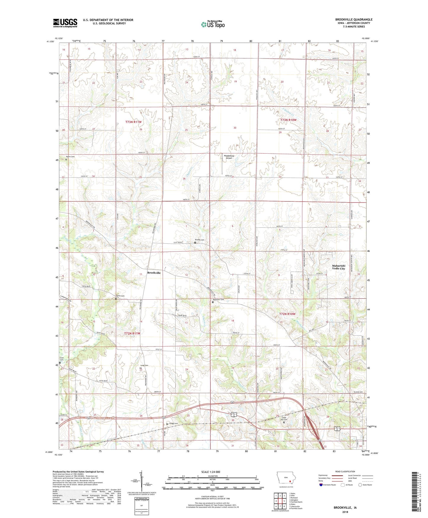
Brookville Iowa US Topo Map
Couldn't load pickup availability
2022 topographic map quadrangle Brookville in the state of Iowa. Scale: 1:24000. Based on the newly updated USGS 7.5' US Topo map series, this map is in the following counties: Jefferson. The map contains contour data, water features, and other items you are used to seeing on USGS maps, but also has updated roads and other features. This is the next generation of topographic maps. Printed on high-quality waterproof paper with UV fade-resistant inks.
Quads adjacent to this one:
West: Abingdon
Northwest: Pekin
North: Ollie
Northeast: Richland
East: Fairfield North
Southeast: Fairfield South
South: Libertyville
Southwest: Eldon
This map covers the same area as the classic USGS quad with code o41092a1.
Contains the following named places: Bernhart, Bernhart Post Office, Brooks Cemetery, Brookville, Brookville Post Office, Cedar Hill Cemetery, City of Maharishi Vedic City, Competine Creek, Coon Cemetery, Gantz Cemetery, Gregg Cemetery, KBCT-FM (Fairfield), KMCD-AM (Fairfield), Long Cemetery, Middlekoop Airport, Moorman Cemetery, Myers Cemetery, Suburban Heights Baptist Church, Suburban Heights Baptist Church School, Township of Black Hawk, Township of Center, Township of Locust Grove, Township of Polk, Witham Woods, ZIP Code: 52580